


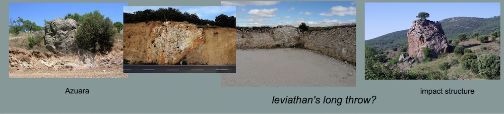


Impact deposit at the Moneva reservoir, Azuara impact structure (Spain)
by Ferran Claudin, Daniel Gorgas & Kord Ernstson (March 2013)
In 2012 in the course of a field trip around the Moneva reservoir (Fig. 1, 2) one of the authors, Daniel Gorgas from Azuara who already in the past had frequently contributed important geologic observations to the Azuara impact research, came across a geologic setting that appeared to drastically deviate from the “normal” deposits well known to him as the extended young Tertiary sediments within the Azuara structure. Following his report we began to study the geological maps of the area around the reservoir (Fig. 2, 3) and then to investigate the outcrops in more detail.

Fig. 1. Location map for the investigated outcrops at the Moneva reservoir within the Azuara impact structure (roughly outlined by a dashed circle).
When we studied the official geological maps of the area, the maps 1 : 50,000, sheet Belchite (IGME 1989) and sheet Muniesa (IGME 1981), as well as the map 1 : 200,000, sheet Daroca (ITGE 1991), we were surprised to see that half a square kilometer of Malmian (tectonics included) in the east and southeast of the Moneva reservoir did not exist on the maps and was instead mapped as Miocene (Figs. 2, 3). The far more precise mapping (Fig. 3) has been the result of a more or less continuous mapping at 1 : 10,000 and 1 : 20,000 scales of the rim region of the Azuara impact structure documented in many theses performed at the university of Würzburg (Germany). The in fact existing Malmian at the Moneva reservoir comprises so-called “margas negras” = black marls (Oxfordian), well-bedded limestones and marls (Oxfordian, Kimmeridge), and massive dolomitic carbonate rocks (Kimmeridge, Tithonian?). Quite a few faults have also been mapped within the Malmian complexes.
The Malmian outcrops as described, but not existing in the official maps, are insofar important as they may shed some light on the peculiar geologic setting discovered by one of us (D.G.) and which we are going to describe here.

Fig. 2. Geological map excerpt, 1 : 200,000 (ITGE (1991). Grid size 10 km.

Fig. 3. Geological map excerpt, 1: 20,000 (Müller 1989). Grid size 1 km. The Moneva reservoir is located upper left.

Fig. 4. The Moneva reservoir and the deposits under discussion. In the base the rocks belong to unit 60 (Upper Oligocene – Lower Miocene), and in the upper part to unit 63 (Middle to Upper Miocene) – according to the annotations to the Daroca map. It is important to note that the Oligocene and Miocene ages for both units are not confirmed in situ.

Fig. 5. Closer view of the general geologic setting.
The typical outcrop situation is shown in Fig. 4 and, from up close, in Fig. 5. In the geological map 1 : 200,000, Sheet Daroca, these rocks belong to number 60 (conglomerates and claystones). The probable age is Upper Oligocene. In the annotations to the Daroca map they occur within the unit UTS T4 and are described as proximal alluvial fan deposits with west – east evolution. On page 157 the authors are explicitly writing (translated): “The deposits in the area of the las Torcas – Moneva reservoir are corresponding to deposits of the braided stream type in which the conglomeratic facies represents longitudinal bars …. The final currents in the section of the las Torcas reservoir are representing sediments that were transported by highly energetic sheet floods leaving gravel blankets and lobes.” [Here we note that the authors probably confuse the Moneva and Las Torcas reservoirs (the latter located near Tosos in the northern part of the Azuara impact structure) or, respect., considering both the same reservoir.]
This characterization follows textbook knowledge and, with regard to the erroneous mapping in the official map mentioned above, can result from cursory inspection at most. In fact, according to our more detailed field work the rocks represent all but a common conglomeratic deposit which is clearly seen and described in the photos to follow.

Fig. 6. Small quarry located to the left of the road ending at the reservoir. It enables insightful study of sedimentary structures and facies.

Fig. 7. Details of the outcrop from Fig. 6. Note the in part imbricated as well as planar layering of the clasts and the erosive base of the upper deposits. Also note the strongly unsorted facies and the dominating angular and subangular, in part sharp-edged broken components defining all but a conglomerate. Rather a diamictite is indicated.

Fig. 8. One more aspect of the deposit. Common textbook description would possibly speak of a paleochannel, but in fact the big block seems to be only an individual clast as part of the strongly unsorted diamictite.

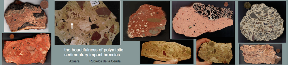
Fig. 9. Close-up of the big block from Fig. 8 showing the contact to the sharp-edged smaller clasts not at all favoring a fluvial deposition. Obviously the block on the whole is a polymictic breccia, and the rounding may be the result of the transportation to its today’s position; see discussion below (Fig. 18).

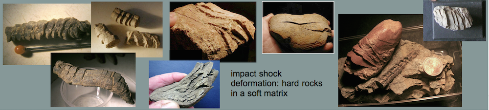
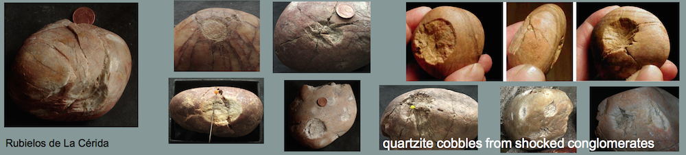
Fig. 10. A sandy-matrix-supported limestone clast showing striations and deformation markings.

Fig. 11. Similar matrix-supported boulder with intense striation and deep imprints. These deformations practically exclude any fluvial transport and the deposit to be a conglomerate. The well-rounded clast very probabably has originated from a conglomerate as a primary deposit, but the transport in its today’s position was a distinctly other process.

Fig. 12. Limestone boulders exhibiting striae and pressure deformations at boulders’ contact. Pressure dissolution may be considered, but in general pressure dissolution is occurring as multiple feature (which is obviously not the case here), and calcareous crusts commonly observed with pressure dissolution are not evident. Instead plastic deformation on pure contact pressure like in Fig. 11 may be assumed. Also Hertzian concussion fracturing should be considered [see HERE].

Fig. 13. Elongated limestone cobble with subparallel open fractues leaving the clast however coherent. The open fractures point to tensile stress which may be the result of dynamic spallation fracturing [see HERE].

Fig. 14. Limestone cobble exhibiting a distinct rotated fracture. Note that the clast is not broken into pieces proving high confining pressure upon deformation.

Fig. 15. The deformed cobble from Fig. 14. seen from above.
Discussion
The outcrop conditions and the peculiar deformation phenomena as seen in the quarry clearly show that the deposit at the Moneva reservoir is not a conglomerate as mapped in the official maps but should be termed a diamictite. Although stratification is indicated the heavy mixture of well-rounded up to sharp-edged fractured clasts, the very bad sorting and the in part matrix-supported texture are incompatible with a fluvial conglomerate. Moreover, the strong plastic deformations like striae, imprints and rotated fractures of the cobbles and boulders are likewise incompatibel with a conglomerate.
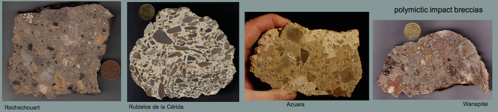
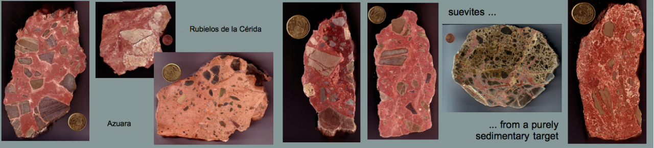
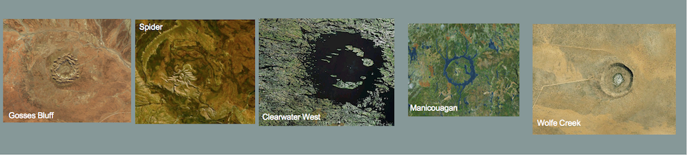
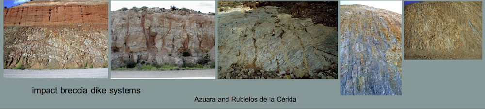
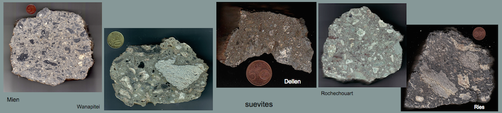
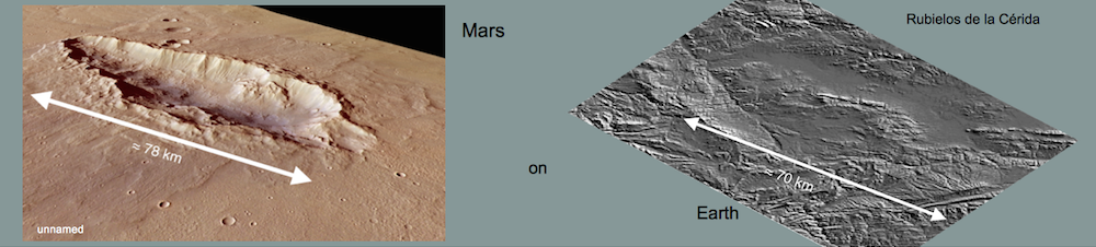
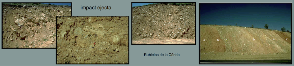
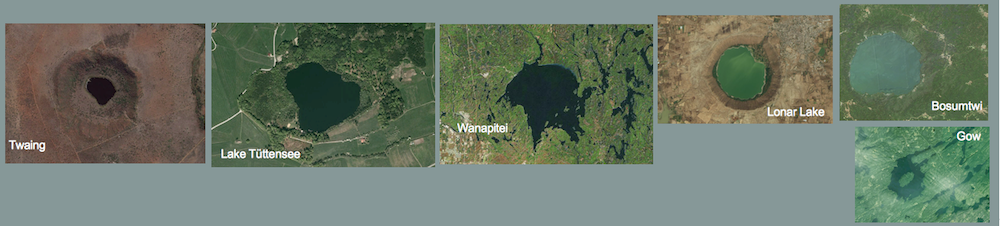
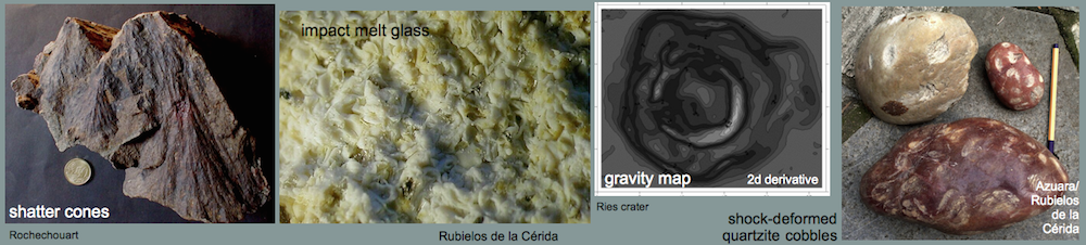
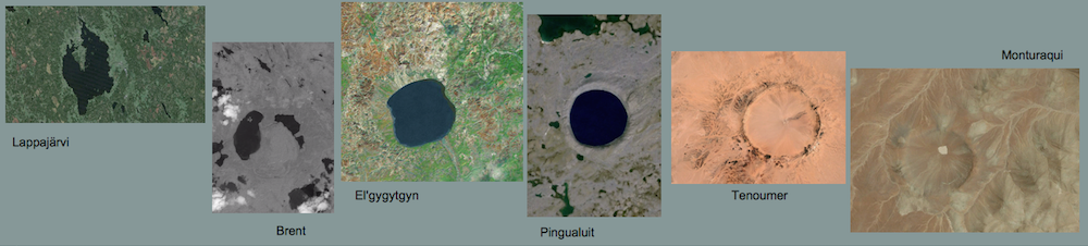
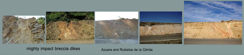
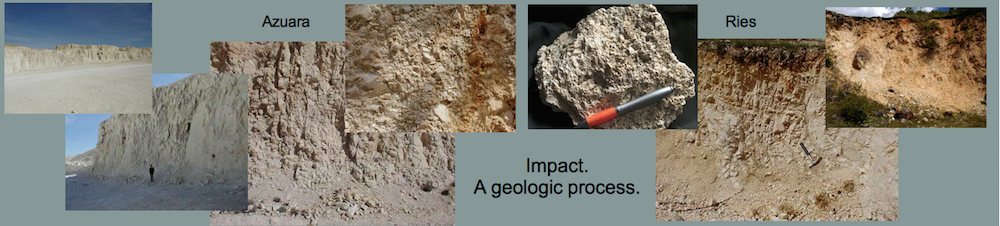
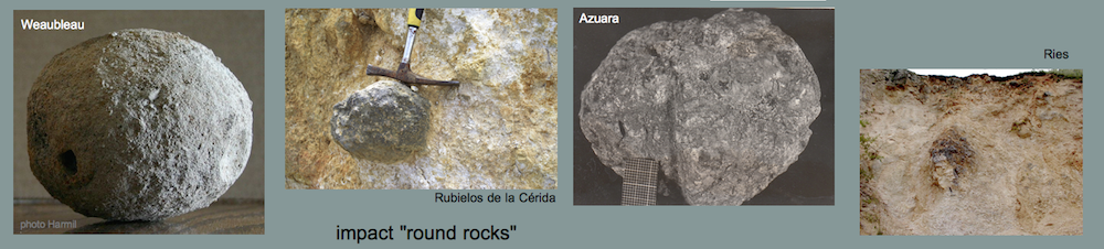
Conventionally and on very cursory inspection the deformations may be attributed to diagenetic processes by compression and compaction or to synsedimentary processes by the dynamics of the material’s deposition. There is however a simple question to be posed why then such features, diamictic sediments incorporating high-pressure deformations, are limited to this region of the Azuara impact structure and not be observed with the many conglomerates elsewhere in a much larger geographical extension. Otherwise and obviously, a similar situation is met at the Puerto Mínguez where extended diamictites have undoubtedly been identified as impact ejecta related with the Rubielos de la Cérida impact basin as a companion to the Azuara impact structure.
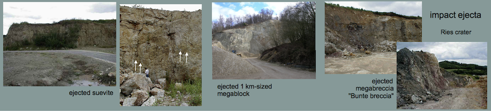
Although rather similar to some parts of the Puerto Mínguez outcrops the occurence of the Moneva reservoir sediments are of course no direct impact ejecta because they are deposited within the Azuara impact cavity. Therefore they are considered to be excavated material from the originally conglomeratic impact target that could not leave the excavation cavity as is known from other impact structures like e.g. from the Ries impact crater in Germany. In the process of excavation, the pre-impact conglomeratic beds strongly suffered from the shock compression and the high-pressure excavation flow leading to the in part heavy fracturing and mixture of the conglomeratic clasts followed by a more or less short reworking with the aid of much water. The outcome of this in principle simple impact-geologic process is today to be seen at the Moneva reservoir in the form of in part well-bedded diamictites exhibiting debris flow or sheet flow features.
The clearly impact-related deposition of the Moneva reservoir sediments is substantiated by a comparison of the Moneva reservoir features with similar typical impact features from other places in the Azuara structure, from the Puerto Mínguez ejecta and from the Ries crater which we show in the following images.

Fig. 16. Reworked impact-excavated material in the Azuara impact structure. To the left: The vertical contact between the heavily destroyed Jurassic limestones and the well-bedded sediments proves an immediate infill after the impact; near Blesa (more HERE). To the right: Reworked impact-excavated material at the Moneva reservoir.
 Fig. 17. Sheet-like components within the Puerto Mínguez impact ejecta and at the Moneva reservoir.
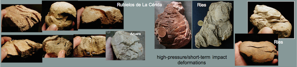
 Fig. 18. In situ-rotated clasts: a typical impact deformation abundantly seen inf the Azuara and Rubielos de la Cérida impact regions. To the left: central uplift chain, Rubielos de la Cérida. To the right: Moneva reservoir. This phenomenon will be discussed in a separate article to follow.
 Fig. 19. Rotated fractures as indicative of high-pressure/short-term deformation. To the left: Puerto Mínguez impact ejecta; to the right: Moneva reservoir [also see HERE].
 Fig. 20. Limestone clasts with heavy striations and deep imprints. To the left: Puerto Mínguez impact ejecta; to the right: Moneva reservoir.
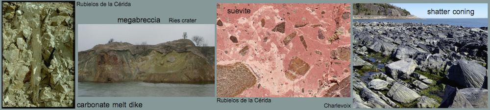
 Fig. 21. Open tensile (spallation) fractures. To the left: from the Ries crater impact ejecta (Bunte breccia). To the right: Moneva reservoir [also see HERE].