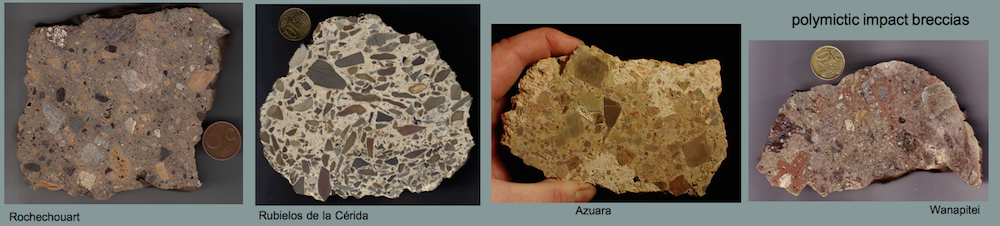
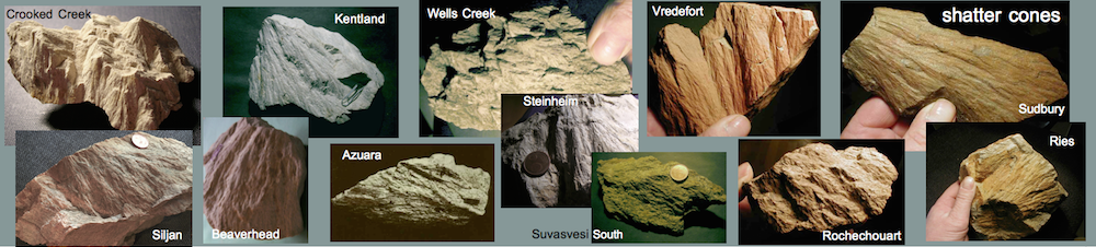
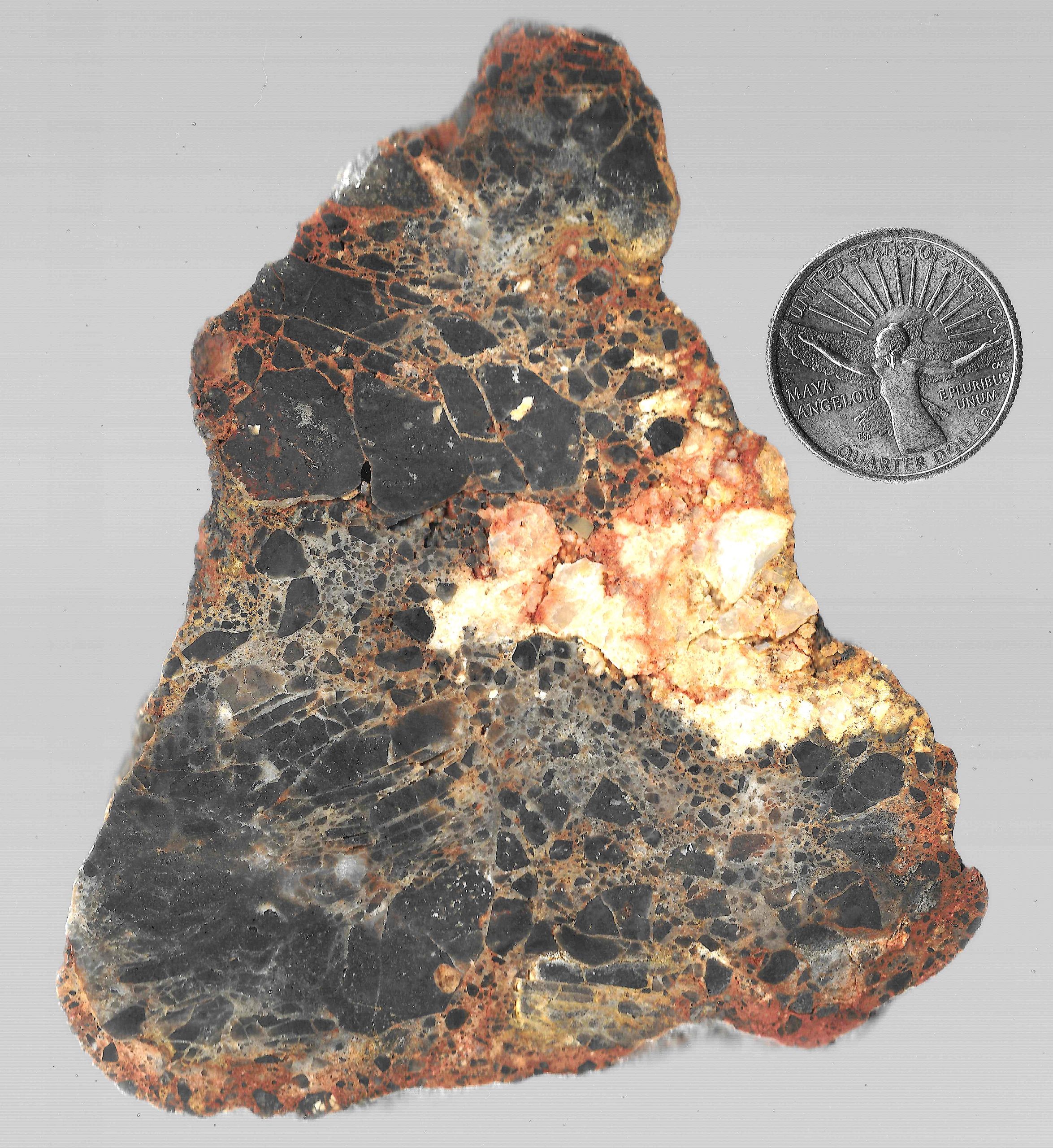
A typical polymictic impact breccia with breccia generations (breccias-within-breccias-within-breccias) – Crooked Creek impact structure, Missouri). Arnold Spitzer collection.
The fitting of the fragments within the larger white and black second generation breccia components proves high confining pressure during transport and emplacement in the finer-grained matrix.
Contributions to the Saarland (Saarlouis/Nalbach), Steinheim, Singra-Jiloca, Czech and Salt Lake impacts: (peer-reviewed abstracts and iPoster Gallery)
Secondary cratering on Earth: The Wyoming impact crater field: More than three question marks. – Comment on the Kenkmann et al. article (GSA Bulletin).
Kord Ernstson, Hans-Peter Matheisl, Jens Poßekel and Michael A. Rappenglück
A short version has been accepted as an abstract paper (for poster presentation) for the 85th Annual Meeting of the Meteoritical Society 2022 in Glasgow, Scotland (6079.pdf, LPI Contrib. No. 2695):
Abstract, table of contents and the full article follow here directly for reading.
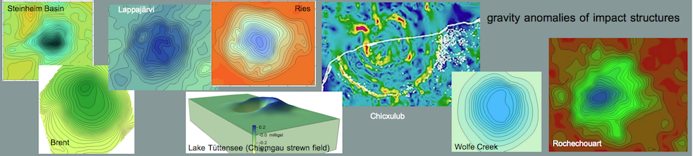
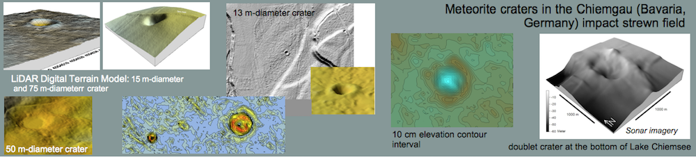
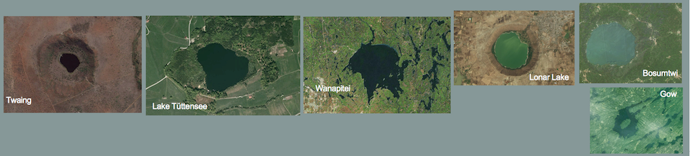
Abstract. – Secondary craters in impacts on moon, planets and their moons are a well known phenomenon, which has been investigated many times. In the article commented by us here, the authors report on a crater strewn field in the American state of Wyoming, which is interpreted as a field of secondary craters of a so far unknown larger primary impact structure and as a first on Earth. We compare the Wyoming crater strewn field with the Chiemgau impact crater strewn field in SE Germany and find that both have nearly identical characteristics of virtually all relevant features, in terms of geometries and petrography. We conclude that the alleged Wyoming secondary crater field is a fiction and the craters attributable to a primary impact. The alleged evidence is very poor to easily refuted. A primary crater does not exist to this day. The negative free-air gravity anomaly referred to, but not even shown, is invalid for this purpose. The Bouguer gravity map shows no indication of a possible large impact structure. Also unsuitable is the use of asymmetries with elongations of assumed secondary craters with a very questionable corridor intersection for the ejecta. Of 31 craters surveyed as proven, 15 are circular (eccentricity 1) and more than half (19) have an eccentricity ≤1.2. Circular and elongated craters are intermixed. The evaluated crater axes may just as well originate in a multiple primary impact. Elongated craters may also result from doublets of overlapping craters that are no longer fresh, as described by the authors themselves. In their paper, the authors do not show a Digital Terrain Model with contour lines for any of the surveyed craters, but only aerial photos blurred by vegetation. A verification of the crater measurements with the deduced eccentricities and strike directions is impossible. Not a single topographic profile over even a single crater in the strewn field is shown, either from DTM data or from an optical leveling, which could have been accomplished in an instant given the relatively small craters. Grave is the misconception that such a large crater field of 90 km length with four separate clusters is not possible according to 20 years old model calculations. A primary impact with multiple projectiles could perhaps be conceivable under rare circumstances, which are described by the authors as not relevant. The alleged impossibility of such a large primary strewn field with referring to the known small impact fields of Morasko, Odessa, Wabar, Henbury, Sikhote Alin, Kaalijärv, and Macha is contradicted by the three larger impact strewn fields of Campo del Cielo, Bajada del Diablo (very likely), and Chiemgau, which are best described in the literature but are not mentioned by Kenkmann et al. with a single word. The comparison of the Wyoming strewn field with the Chiemgau impact crater strewn field of about the same size here in the commentary article proves the scientifically clearly much greater significance of the Chiemgau impact, which must be considered as currently the largest and most significant Holocene impact despite the rejection and ignoring in some parts of the so-called impact community.
At this year’s LPSC, there have been two iPoster contributions to the Steinheim Ìmpaktkrater. It is about the alleged time difference between the impacts of Ries and Steinheim Basin (articles Buchner et al. 2020). In the LPSC article the authors Schmedemann and Hiesinger show that depending on plausible assumptions of the statistics the probability of a non-simultaneous impact is in the per mille range. A separate impact is therefore described as extremely unlikely.
The second LPSC contribution takes up in this context once more the topic of the small pseudo impact of the Steinheim Basin, which is used in the so-called “impact community” against actually better knowledge further everywhere in the impact literature with consistently wrong results.
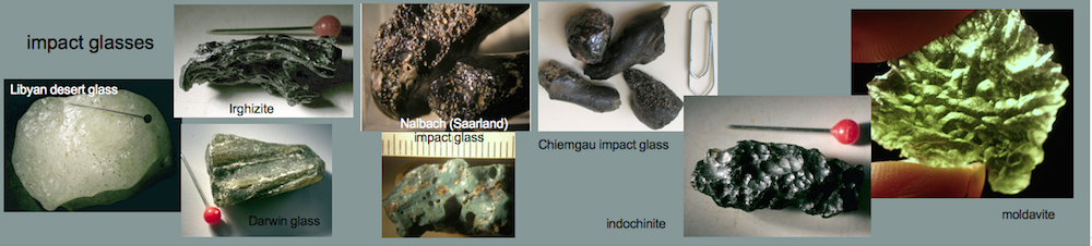
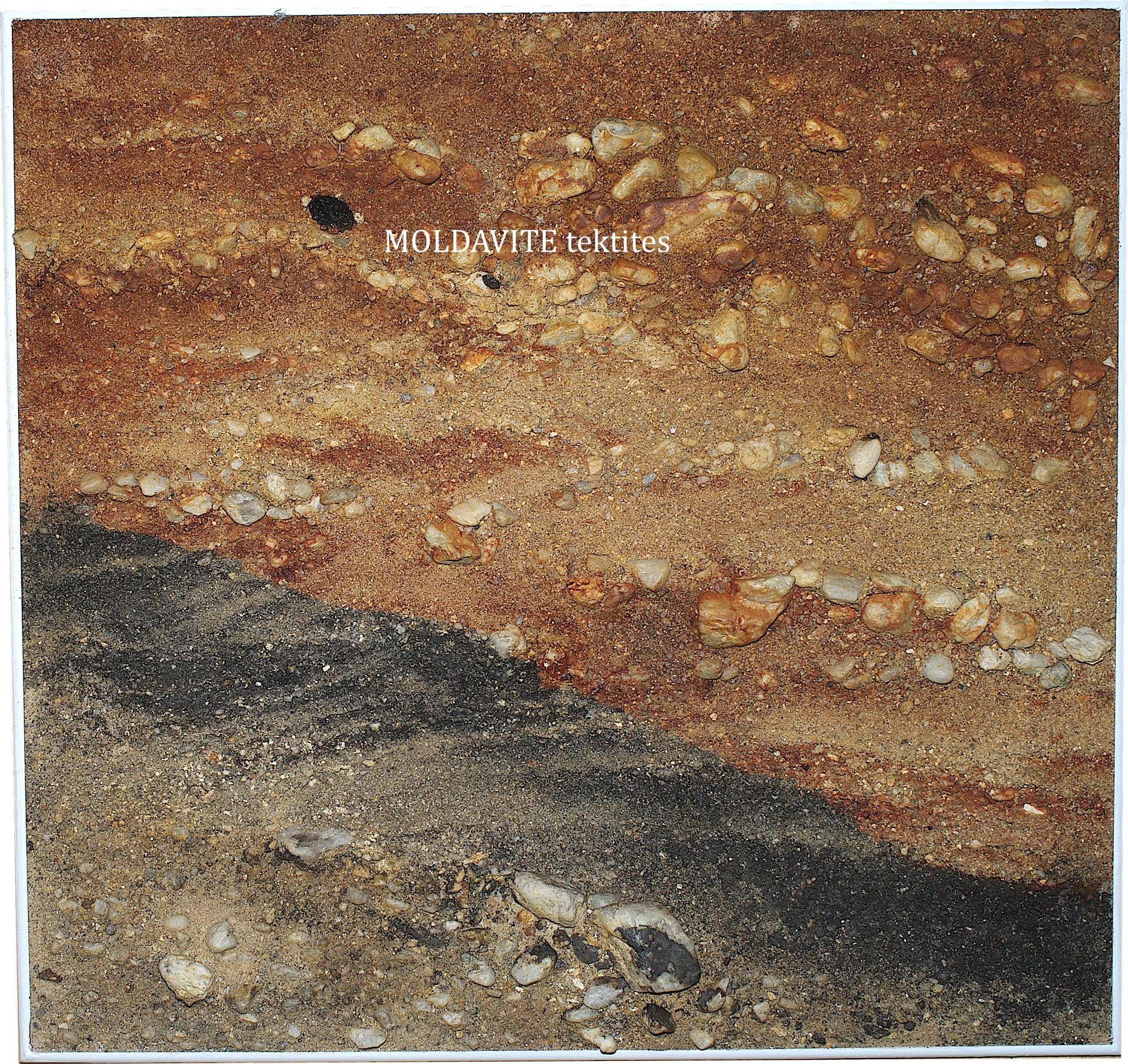
Lacquer print from the wall of a quarry in Dřenice near Cheb in West Bohemia (Czech Republic). It is a river sediment, probably of Pliocene age. The rusty part is discolored by limonite and goethite. Rarely moldavites occur in it. The black part is discolored by psilomelane. 56 cm x 56 cm.
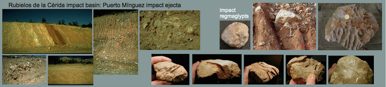
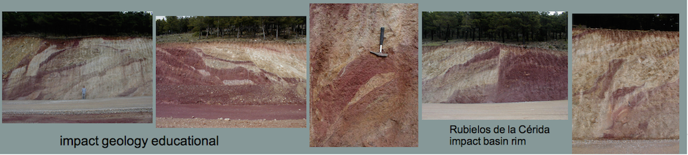
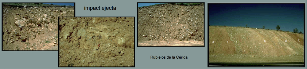
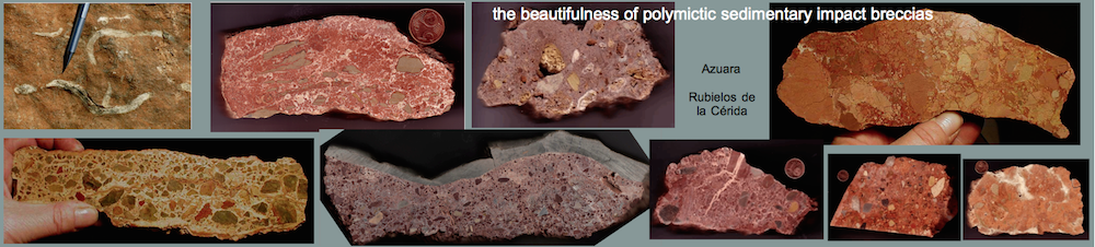
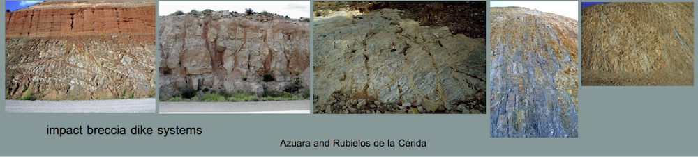
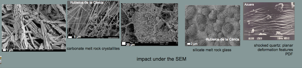
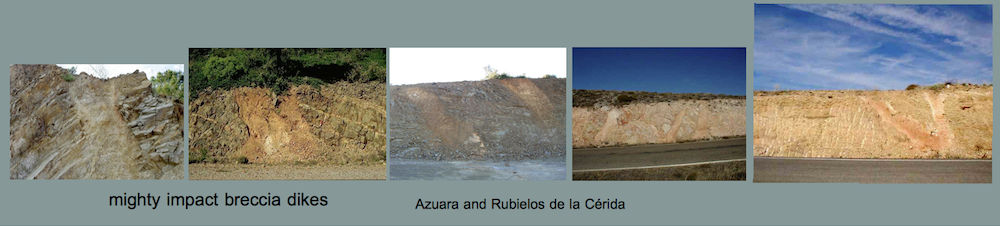
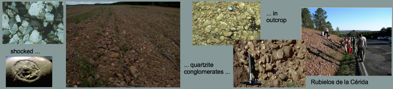
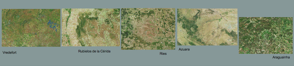
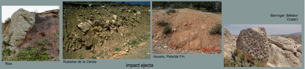
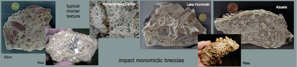
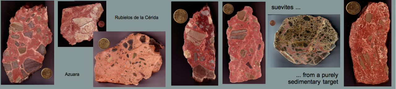
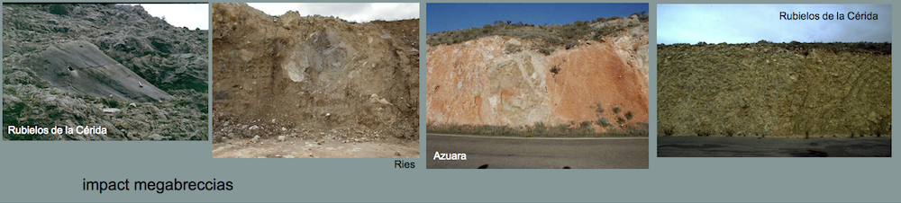
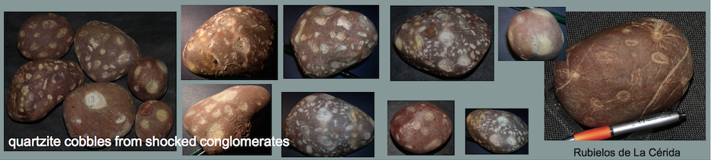
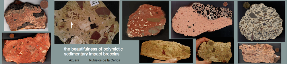
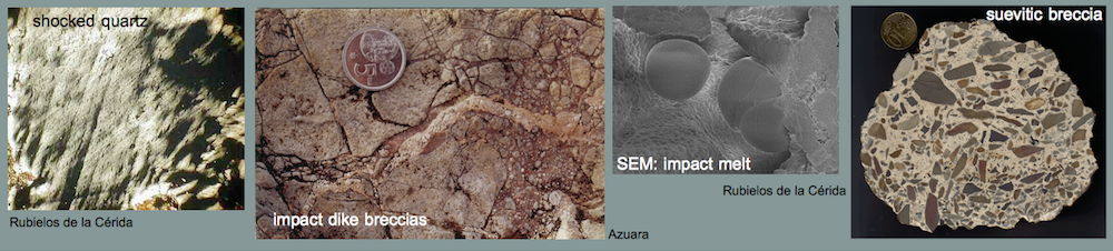
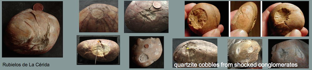
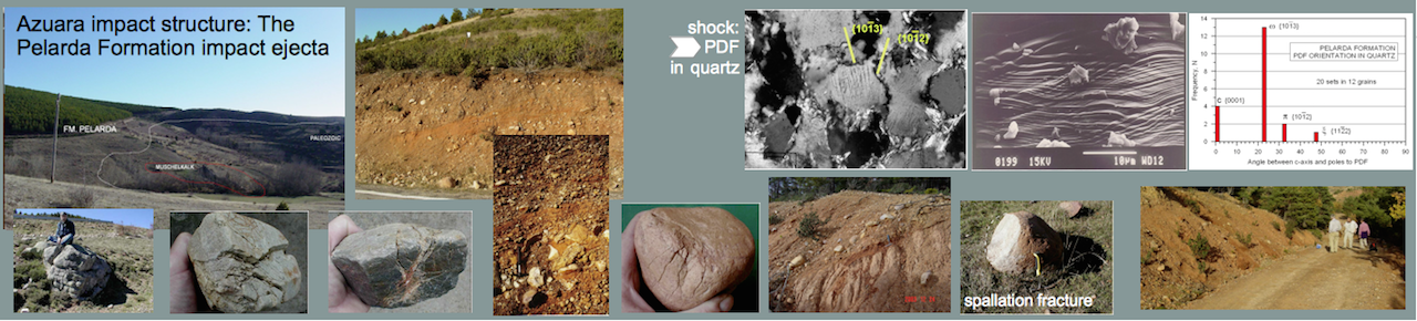
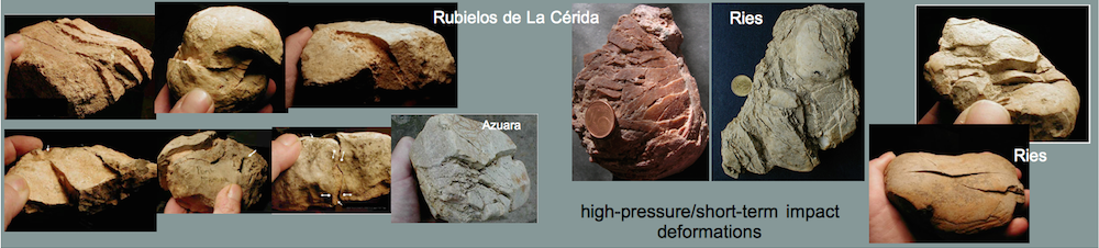
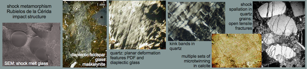
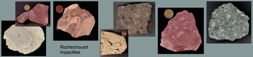
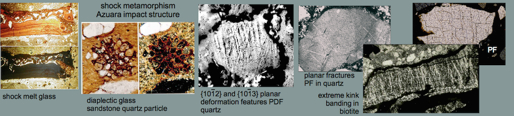
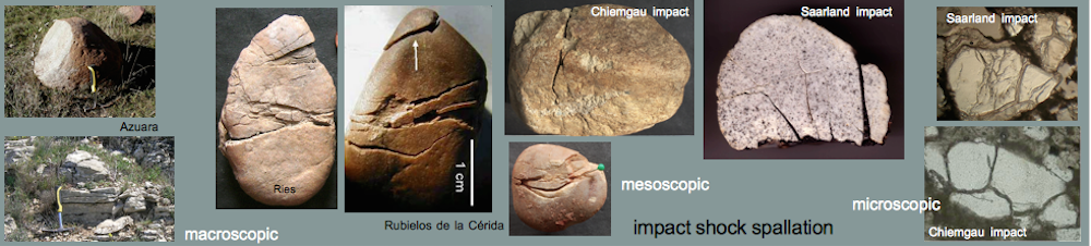
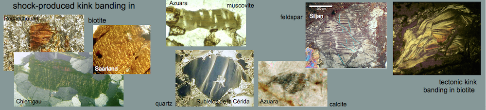
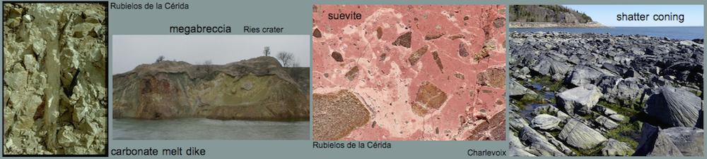
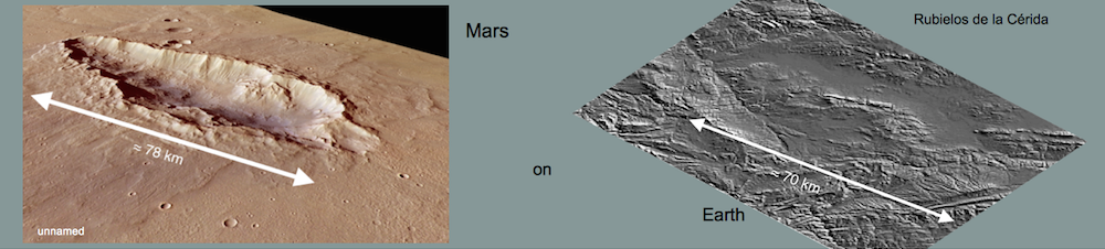
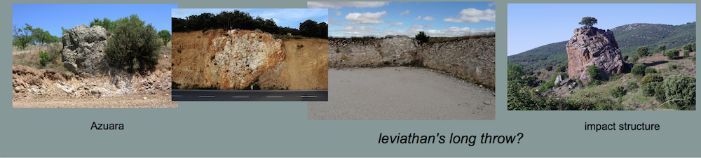
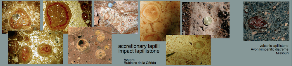
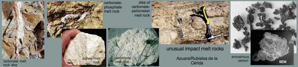
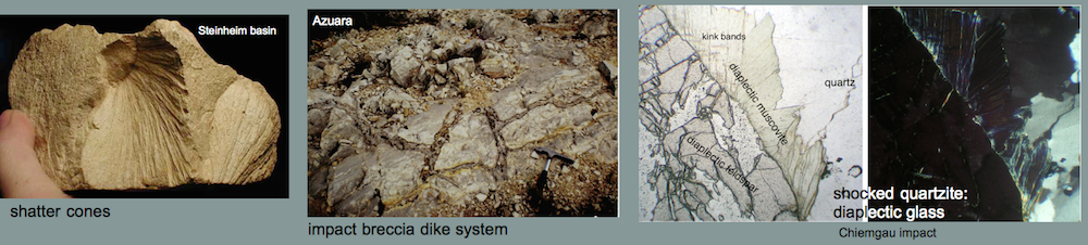
Shock metamorphism in the Rubielos de la Cérida impact basin (Eocene-Oligocene Azuara multiple impact event, Spain) – reappraisal and photomicrograph image gallery
by Kord Ernstson1 and Ferran Claudin2 (April 2021)
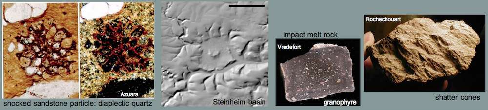
Abstract. – We present a new compilation of previously abundantly studied and published shock effects in minerals and rocks of the Middle Tertiary Rubielos de la Cérida Impact Basin in northeastern Spain. Typologically, we organize by: shock melt – accretionary lapilli – diaplectic glass – planar deformation features (PDF) – deformation lamellae in quartz – isotropic twins in feldspar – kink banding in mica and quartz – micro-twinning in calcite – shock spallation. Included are the newly associated Jiloca-Singra impact in the so-called Jiloca graben and the Torrecilla ring structure, which immediately adjoins the Rubielos de la Cérida basin to the northeast. The compilation and presentation also opposes once more the still existing fundamental rejection of an impact genesis of the Azuara impact event by leading impact researchers of the so-called impact community and by regional geologists from the University of Zaragoza.