

by Ferran Claudin & Kord Ernstson (2012)
Abstract
A nappe-like thrust of Cambrian over Tertiary, the Daroca thrust, in northeast Spain has puzzled geologists since longtime. Because of a lacking root zone and a lacking relief it didn’t match a reasonable geologic pattern. In the younger regional geologic literature the thrust is nevertheless incorporated in Alpine regional tectonics. An obviously first closer investigation of the involved Cambrian and Tertiary units, their facies and structural setting leads to a model that relates the Daroca thrust to the nearby roughly 40 km-diameter Azuara impact structure. The thrust is part of the excavation stage of impact cratering which may have affected both the Cambrian plate and the diamictic Tertiary below. The model is strongly substantiated by comparison with the Ries impact structure where similar thrusts and related features occur. The Daroca thrust is one more example reflecting the work of the regional geologists who pretend the giant Azuara impact event with the formation of the Azuara impact structure and the adjacent about 70 km Rubielos de la Cérida elongated impact basin never happened. Hence, all their regional geologic models still developed which completely ignore the impact and its radical influence on the Tertiary regional geology are without any scientific relevance.
1 Introduction

Fig. 1. Daroca, Province of Zaragoza, Spain.
The very nice town of Daroca in the Spanish Province of Zaragoza (Fig. 1) hides a peculiar geologic scenario – an enigma for geologists from time out of mind. Being enthroned above the town the geologic stratigraphy shows with a very sharp cut Cambrian dolomite (Ribota dolomite) over Tertiary young sediments (Fig. 2). Older layers over younger ones are not uncommon in geology, and overthrust and thrust faulting are related processes.

Fig. 2. The Daroca thrust: knife-sharp contact of Cambrian over Tertiary.
But Daroca is different. The Cambrian plate is kilometer-sized and fragmented into larger blocks, and a Tertiary 180° overtrust can reasonably be excluded. Early geologists confronted with the situation in sheer desperation thought of a preexisting Cambrian autochthonous plate and a vast undercutting by the Tertiary. Today this explanation is left out of consideration and simple thrust faulting is being favored. But the case is all but simple. There is no root zone and not any relief from where the giant plate could have started to override the Tertiary around Daroca. Nevertheless, the thrust kinematics are developed further by geologists (e.g., Capote et al. 2002), and tens of kilometers long faults are drawn within models of syn-tectonic sedimentation (Casas et al. 2000; Fig. 3).

Fig. 3. The Daroca thrust as integrated into the thrust-and-fold kinematics of the Montalbán Basin (after Casas et al. 2000). Dashed yellow: rough outline of the Azuara impact structure. Map modified from ITGE (1991).
Different from earlier workers on the Daroca geology we took a somewhat closer look at the facies and the structural setting of the involved Cambrian and Tertiary units, and here we present a model that relates the Daroca geology with the near Azuara impact structure (Ernstson et al. 1985, 1987, 2001, 2002, 2003; Ernstson and Fiebag 1992; Ernstson and Claudin 1990; Claudin and Ernstson 2003; Ernstson 1991, 1994) and that is able to explain many features so far not having been taken into consideration by geologists.
2 The observations
We start on the small scale of the Daroca outcrops before considering the larger geologic context. Simplifying, the Daroca zone shows as the Cambrian dolostone block having overridden younger Tertiary sediments. Going into detail the structural features are however much more complex implying more stratigraphical units which will be peripherally considered here only, because they do not contribute significantly to the model to be developed.
2.1 The Tertiary
In the official geological maps of Spain (ITGE 1991, Hernández et al. 1983) the Tertiary around Daroca is indicated as “conglomerates” and as “conglomerates, red silts and clays”. For the stratigraphical unit below the Cambrian plate this is obviously not correct. The facies is a mixture of badly sorted to unsorted rounded and angular components, the grain size varies between sand and larger blocks, and the term “diamictite” seems much more appropriate (Figs. 4, 5, 6).

Fig. 4. The Tertiary below the Daroca thrust. Note the lenticular segregation bodies.

Fig. 5. Typical diamictic texture of the Tertiary below the Daroca thrust.

Fig. 6. The diamictic texture of the Tertiary in close-up.

Fig. 7. Stratification of the Tertiary below the Daroca thrust.
Stratification from absent (Fig. 5) over poorly developed up to well-bedded (Fig. 7) can be observed. Frequently, sediment units forming lenticular bodies seem to merge into one another (Fig. 4). A large number of clasts are heavily fractured while their coherence may largely be preserved (Fig. 8, Fig. 9).

Fig. 8. Fractured but coherent clast embedded in the Tertiary diamictite. The fragmentary sharp-edged boulder proves fracturing, transport and deposition under high confining pressure.

Fig. 9. A fragmentary dolostone block with preserved bedding intercalated in the Tertiary diamictite, obviously not a conglomerate.

Fig. 10. Piles of Cambrian dolostone blocks are intercalated in the stratified Tertiary sediments.
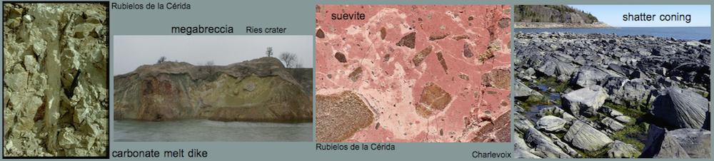
A complex process of deposition of the Cambrian and Tertiary units is indicated by the accumulation of larger fragmented dolostone blocks intercalated in the stratified Tertiary conveying the aspect of a megabreccia (Fig. 10).
2.2 The Cambrian
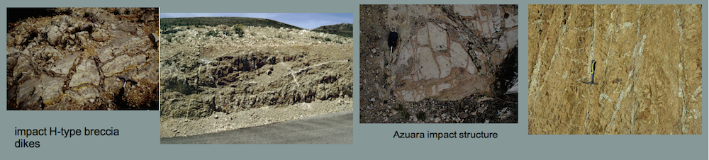
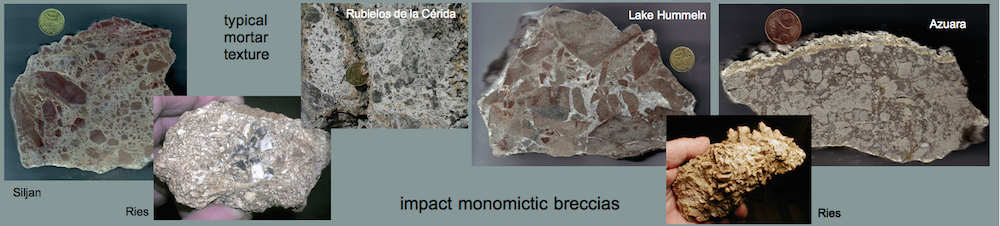
Apart from the Ribota dolomite exposed in the Daroca thrust upside the town (Figs. 2, 10) the Lower Cambrian rocks around Daroca comprise mostly quartzitic sandstones and argillaceous slates. More or less all of them are heavily shattered, strongly deformed and frequently interfingered (Figs. 11-15 ). Dike-like injections and patchy inclusions occur. Large volumes of the Ribota dolomite plate are converted to a monomictic movement breccia (Reiff 1978), and mortar texture and grit brecciation have affected most layers.

Fig. 11. Strongly deformed and interfingered Lower Cambrian units from the Daroca thrust; southeast of the town.

Fig. 12. Strongly deformed Lower Cambrian units (probably Daroca sandstone and Valdemiedes Fm.) kneaded together and displaying mortar texture and grit brecciation. From the Daroca thrust; southeast of the town.

Fig. 13. Injection of grit-brecciated quartzitc sandstone (Daroca sandstone ?) into nearly pulverized slates (Valdemiedes Fm. ?). Daroca Cambrian thrust; southeast of the town.

Fig. 14. Monomictic movement breccia exhibiting mortar texture and grit brecciation. Ribota dolomite from the Daroca thrust upside the town. It is emphasized that we are not dealing with a simple fault breccia; the brecciation has covered large volumes of the Ribota dolomite.
Although the rock damage around Daroca is exceptional, also the Cambrian rock units strung along the Daroca thrust to the south are abundantly heavily deformed, and we show but one example exposed north of Burbáguena some 12 km southeast of Daroca (Fig. 15).

Fig. 15. Strongly deformed Cambrian at the Daroca thrust near Burbáguena.
2.3 The contact
In a general view the Daroca thrust may alternatively be considered an inverted unconformity of Tertiary over Cambrian (Fig. 16). This is clearly not the case, and therefore the relative movement between the strongly competent dolostone plate and the strongly incompetent Tertiary diamictite must have been very energetic and rapid to allow the development of the very sharp contact without any significant tunneling of the soft Tertiary.

Fig. 16. “Inverted unconformity” of Cambrian and Tertiary at the Daroca thrust.
On a closer look (Figs. 17, 18) the “unconformity” does not concern Cambrian over Tertiary. The sharp cut separates the heavily brecciated dipping Ribota dolomite with preserved bedding from a broader zone of finely ground and in part pulverized dolostone discontinuously merging into the Tertiary diamictite pointing to a thrust mechanism anything but simple.

Fig. 17. The contact zone between bedded Ribota dolomite and grit-brecciated dolostone.

Fig. 18. The contact zone like in Fig. 17 with branching injection of dikelets of red clay into the top dolostone.
The contact at the base of the more coherent Ribota dolomite shows as a ribbon of red clay interspersed with dolostone particles (Figs. 17, 18). Dikelets of the red clay have obviously been injected into the heavily fragmented dolostone (Figs. 18, 19) speaking against a slow step by step tectonic thrust.

Fig. 19. The brecciated top dolostone carrying irregularly injected reddish dikelets.
2.4 Age of the thrust
Following the official geologic maps (ITGE 1991, Hernández et al. 1983) the Tertiary around Daroca as part of the Calatayud basin (ITGE 1991, Capote et al. 2002) and overridden by the Cambrian plate is of Miocene age. Hence, according to regional geologists the thrust must be Miocene or younger. As has been shown before, for the diamictic Tertiary below the Daroca plate the characterization of a Miocene conglomerate does not hold true. Hence, since a paleontological dating does not exist and the special diamictic facies does not allow any litho-stratigraphical parallelization the age of the thrust remains completely open and may be even Oligocene, Eocene or Paleocene.
3 The meteorite impact model for the Daroca thrust
3.1 The geologic frame
At the beginning we mentioned the thrust faulting problem because seemingly there is no nearby root zone and no relief from where the Cambrian plate could have started to override the Tertiary. Now within the frame of our model we in fact present a root zone, and the lacking relief for a thrust is replaced by a force actually not very common in geology. We propose the root zone to be the rim region of the Azuara impact structure east of Daroca, and the force needed for the transport of the Daroca plate to be the giant excavation mass flow initiated by the impact and the propagating shock front.
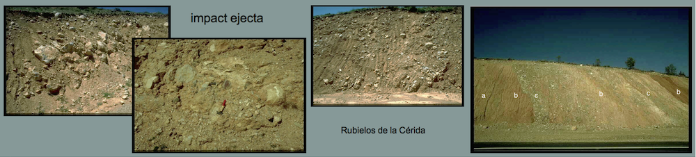
The basic idea and geological situation is shown in Fig. 20. In the geological map excerpt (from the 1 : 200 000 map, ITGE 1991) we have marked the center of the roughly 40 km-diameter Azuara impact structure (referenced in the Introduction) and the Cambrian units 5 – 6 especially involved in our impact model. For the Cambrian Almunia Fm. (8) probably dislocated bodies have been separately identified. A “compressed unit” (9) composed of Cambrian units 5, 6 and 8 is also indicated, furthermore the extension of the Pelarda Fm. impact ejecta of the Azuara structure (Ernstson and Claudin 1990, Ernstson et al. 2002).

Fig. 20. Geologic excerpt map (from ITGE 1991) showing most part of the Azuara impact structure and the geologic units involved in the model for the Daroca thrust. Unit 7 is composed of non-differentiated units 5 and 6.
We begin with the extended outcrops of Cambrian units 5 – 6 at the upper left of Fig. 20 and observe a sudden break in the Iberian NW – SE strike direction. In the following roughly 40 km long gap only three very small remnants appear to be preserved. Peculiarly, more or less exactly at the level of the break in the Eastern Iberian Chain we see a sudden onset of the same units 5 – 6 in the Western Iberian Chain about 10 km northwest of Daroca. These units, interrupted by two blocks of Almunia Fm. (8), can be traced over roughly 30 km along the Western Iberian Chain, and again a sudden break occurs in favor of an onset of units 5 – 6 to the east and northeast.
The mentioned gap in the Eastern Iberian Chain is not completely devoid of units 5 and 6. According to the map (ITGE 1991) a unit 9 is indicated and labeled “compressed unit of 5, 6, 8” (see Fig. 20). Not further addressed in the explanatory notes to the geological map this characterization of unit 9 can only be interpreted by a drastic structural compressive overprint and intermingling with the outcome that the individual units can no longer be subdivided. Typical examples of this compressed zone are nicely exposed e.g. in the environs of Cucalón (Figs. 21 – 24).

Fig. 21. Photo taken in the “compressed unit (9)” near Cucalón.

Fig. 22. The “compressed unit (9)” near Cucalón living up to its name.

Fig. 23. Dislocated and completely grit-brecciated megablock in the “compressed unit (9)” near Cucalón.

Fig. 24. Close-up of Fig. 23.
3.2 The Olalla Cambrian block
With regard to the map in Fig. 20 the Olalla block (Fig. 25) is located somewhat isolated between the Western and the Eastern Iberian Chain. A very comprehensive and excellent mapping of the block has been performed as early as in the seventies (Monninger 1973) which we will not consider here in detail. We want however to mention peculiarities already described in Monninger (1973). We point to the Mesozoic units of Buntsandstein, Muschelkalk and Keuper attached to the Cambrian. The Buntsandstein is overturned (Monninger 1973), and we found that also the Muschelkalk and Keuper unit is at least in part overturned. [In the official geologic map (ITGE 1991) this has led to the erroneous designation of the Muschelkalk on top of the Keuper as Rhaethian/Liassic (Cortés de Tajuña Fm.). The error is explained by the confusion of the well-known collapse brecciation of the Cortés de Tajuña Fm. with the heavy megabrecciation the Muschelkalk underwent in the course of the Azuara impact event. In the rim zone of the Rubielos de la Cérida impact basin large areas of heavily brecciated Muschelkalk limestones and dolostones have likewise been mapped as Rhaethian/Liassic erroneously leading to the curious setting of a large “island” of Buntsandstein in the midst of extended “Rhaethian/Liassic” between Corbalán and El Pobo (IGME 1985).]

Fig. 25. The Olalla block suggested to be dislocated from the rim zone of the Azuara impact structure. The Buntsandstein in the Olalla block is missing in the official geological map but has been mapped by Monninger (1973). In the Olalla block the Muschelkalk has erroneously been mapped as Rhaethian/Liassic in the official geologic map. The unit 76, adjacent to the Olalla block and more or less representing the Azuara impact ejecta (Pelarda Fm.), has erroneously been mapped as Quaternary (also see Fig. 20). – Map excerpt from ITGE (1991).
Apart from the inversion of the Mesozoic the thrust fault of the Cambrian over the Muschelkalk/Keuper unit in an impressively exposed polished thrust plane (Fig. 26) attracts attention. Not only here but also in enormous volumes of the Olalla block both in the Muchelkalk (Figs. 27 – 29) and the Cambrian Fms. (Figs. 30 – 31) the rocks are drastically deformed and crushed. Monninger (1973) is speaking of (uncemented) mylonitization to rock grus and powder that has hit nearly all stratigraphical units having led to typical badlands terrains (Fig. 32). Interestingly and anticipatorily Monninger states in his thesis, written in times when impact geology was an issue not even rudimentarily, that the extraordinary destructions need in-depth studies for the understanding of the peculiar setting that obviously excludes “normal” tectonics and requires toing and froing at minor depth. In this context we propose to regional geologists to study the Monninger (1973) work thoroughly when developing their “well-spaced” models of Tertiary regional geology (also see below).

Fig. 26. Thrust fault of Cambrian over heavily crushed Muschelkalk limestone in the Olalla block. Possibly, the whole complex of Mesozoic (Keuper and Muschelkalk) and Cambrian is overturned.

Fig. 27. Widespread megabrecciated Muschelkalk limestone/dolostone in the Olalla block.

Fig. 28. Mortar texture in the Muschelkalk megabreccia seen in Fig. 27.

Fig. 29. Grit brecciation in the Muschelkalk megabreccia seen in Fig. 27.

Fig. 30. Quarry in Daroca quartzitic sandstone in the Olalla Cambrian block about 3 km SSE of Laguerruela. The rock is grit-brecciated through and through to such an extent that it can be removed from the wall as pure rubble.

Fig. 31. The quartzitic sandstone from Fig. 30 pulverized to voluminous rock flour.

Fig. 32. Typical badlands terrain in grus and grit-brecciated rocks of the Olalla block. Photo taken from Monninger (1973).
Altogether, from the observations made in the Olalla block, the enormous destructions and the close association of the Buntsandstein/Muschelkalk/Keuper complex with the Cambrian, we suggest that the isolated block is not autochthonous but was detached from the stratigraphically similar setting roughly 10 km to the northeast as indicated in Fig. 25.
3.3 The Azuara impact, the Daroca thrust and the dislocation of the Olalla block
From the preceding sections it has become obvious that the Daroca thrust probably has a companion in the form of the Olalla block which is especially revealed by the geological map in Fig. 20 where we will fix our model. Accordingly, we suggest that the Cambrian units 5 and 6 were located in their original pre-impact position more or less continuously strung along the Eastern Iberian Chain. Then, in the Eocene or Oligocene the giant Azuara impact event happened forming in its northern part the roughly 40 km-diameter Azuara impact structure, in the southwest developing its rim in the region of the exposed Cambrian chain. From there the Cambrian units were accelerated in the course of the impact excavation and ejection stage to land in their today’s position at the eastern margin of the Western Iberian Chain. The movement did not take place in a single strand but reacted to the locally strongly varying impact stress field and the morphological and lithological conditions. This was probably the reason for the breakup of the dislocated Cambrian chain into individual blocks and for the Olalla block to become detached from the Cambrian/Mesozoic setting as shown in Fig. 25.
The model is strongly substantiated by the significant setting of the “compressed unit (9)” exactly in the sector (and only existing there) that corresponds with the Daroca thrust and the affected segment of the Azuara structure rim region (Fig. 20). It must be left to further investigations whether this “compressed unit” has also been dislocated as ejecta from the crater rim region or whether it is autochthonous or parautochthonous. This question will be addressed also in the next chapter.
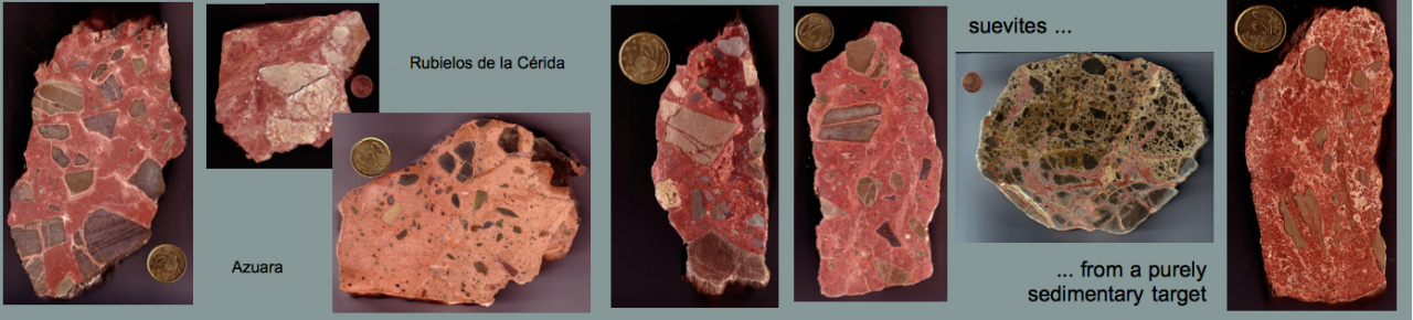
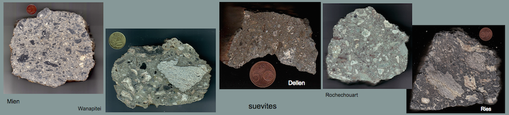
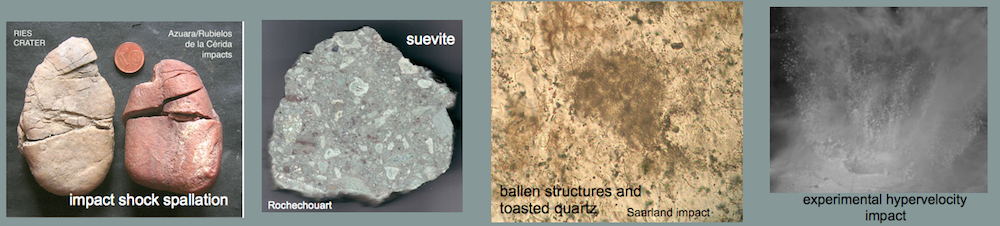
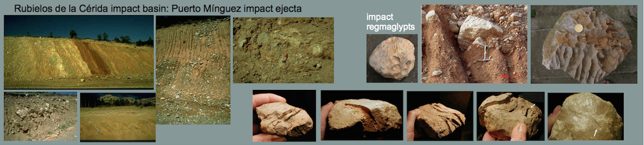
With regard to the impact event more evidence of the special position of the mentioned sector is given by extended deposits of the impact suevite breccia (Ernstson and Fiebag 1992, Ernstson et al. 2002) peculiarly exposed in the environs of Cucalón (Figs. 25, 33, 34). More suevite deposits are exposed in the area of the Olalla block where the impact is additionally omnipresent in the form of the large Pelarda Fm. impact ejecta deposit (Figs. 20, 25).

Fig. 33. Massive outcrop of the basal suevite impact breccia near Cucalón. Note the steeply dipping platy jointing which has possibly originated from cooling of the suevite body.

Fig. 34. Cut slice of the Cucalón suevite.
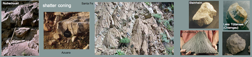
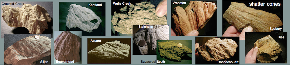
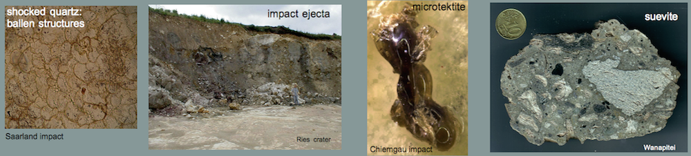
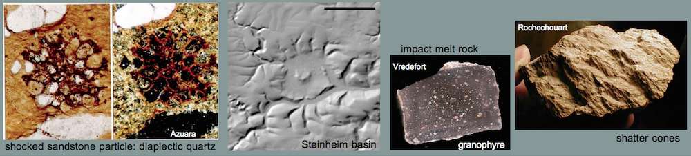
Within the Cambrian siltstones of the Olalla block fairly well developed shatter cones have been sampled (Fig. 35). This is one more evidence that the block is allochthonous and has been detached and dislocated from the impact rim zone. Shatter cones are rare in the Azuara structure because they require shock pressures for their formation that are best given in the center of an impact crater and more or less limited to the crater area. The interior of the Azuara structure is filled by post-impact young sediments, and therefore shatter cones could so far be found only in the rim region (Ernstson et al. 2002). Since the impact shock pressure rapidly decreases with distance a shatter cone formation about 10 km distant from the crater rim in an autochthonous Olalla block seems to be rather unlikely. However, shatter cones in rocks develop in the very first instances of the impact cratering process in the so-called contact and compression stages, only then followed by the mass movements in the excavation and ejection stage. Hence, in situ formation of the Olalla shatter cones at the crater rim and subsequent dislocation of the block seems to be a reasonable setting.

Fig. 35. Shatter cones as shock indicator in Cambrian siltstones from the Olalla block. Photo to the right by courtesy of P. Bockstaller.
In the Olalla block also the Cambrian Almunia Fm. (unit 8) has been mapped (ITGE 1991), and in Fig. 25 it has been treated as equal to units 5 and 6, i.e. unit 8 is also considered allochthonous. In the geological map of Fig. 20 we have addressed unit 8 by contrast separately. The reason is simple because the Almunia Fm. has been mapped over extended areas west of the Jiloca river. Hence, the unit 8 is without doubt autochthonous there and very probably not significantly affected by the impact. The blocks of the Almunia Fm. east of the Jiloca and intercalated in the proposed dislocated Cambrian units 5 and 6 of the Daroca thrust (Fig. 20) must be considered differently. They may also be dislocated from the Cambrian in the Eastern Iberian Chain, or they may be not and hence belong to the autochthonous stratigraphy. We will discuss the respective setting in the next chapter.
4 For comparison: The Ries impact structure
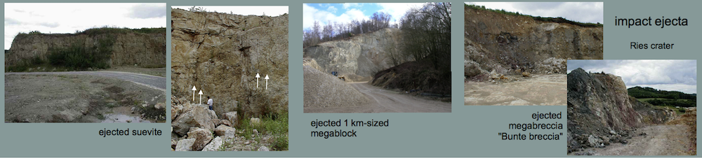
The Ries crater (Nördlinger Ries) in Germany (Pohl et al. 1977) is one of the best investigated impact structures worldwide. It has a diameter of about 25 km and is of Miocene age. Among impact researchers the Ries crater is outstanding because of the excellently preserved impact ejecta. They comprise multicolored fragmented material, dislocated megablocks and together with the so-called Bunte breccia ejecta form a real megabreccia (Fig. 36). The well-known Ries suevite (the Ries in Swabia is the type locality for this impact rock also typical for the Spanish impact structures [1]) occurs as a big layer within the crater but exists also as ejecta deposits.

Fig. 36. Geologic sketch map of the Ries impact structure.
For the understanding of the geological setting in the zone of the Daroca thrust and the proposed dislocated Olalla block a comparison with the Ries crater and its ejecta blanket is highlighting and basically educational, and there is much in the Ries crater area to be observed that has become impact textbook knowledge. Here we want to especially focus on dislocated and ejected megablocks, their facies and structural setting having much in common with the situation in the Daroca – Cucalón – Olalla region.
The very large dislocated megablocks in the environs of the Ries crater were one of the greatest enigmas geologists were originally confronted with at times when the Ries was generally considered a volcanic explosion structure. How could a volcanic explosion be able to throw kilometer-sized coherent blocks over distances of more than 10 km? The answer came in the sixties with the identification of the Ries as a large impact structure implying a giant energy release. With regard to the Spanish impacts and the geologic setting under discussion we consider two exposures in the Ries crater megablock zone (Fig. 36). At Oppertshofen, some 7 km distant from the Ries crater rim, a big 1 km sized Malmian limestone megablock has been mapped to lie there completely overturned. We need not make a feature of the relation to the Olalla block and point to the fact that this coherent 1 km Oppertshofen megablock with fully preserved bedding and karst structures must have been overturned and moved over a distance of at least 7 km in the process of the impact event.
The second example is provided by the Iggenhausen Malmian limestone megablock (Figs. 37 – 39). Here, the dislocation distance from the Ries crater is at least 15 km, which is of the order of the separation of the proposed dislocated Cambrian blocks of the Daroca thrust. And there is more conformance considering the radical and voluminous destruction of the rocks down to grit and grus and in part to rock flour which is shown in the Figs. 11 – 14, 27, 30- 32 for the Daroca thrust and the Olalla block, and in Figs. 37 – 39 for the Iggenhausen dislocated megablock.

Fig. 37. Ries crater, Iggenhausen quarry set up in a drastically brecciated Malmian limestone megablock. The megablock must have been ejected over a distance of at least 15 km.

Fig. 38. Detail of the grit-brecciation in Fig. 37.

Fig. 39. Close-up of Fig. 38.
Just imagine the geological exposure from Fig. 40 to be a pattern for the Cambrian rocks (e.g., the Ribota dolomite) in the Eastern Iberian Chain at the time of the Azuara impact event. The limestones and dolostones in Fig. 40 just outside the Ries crater rim are representing the rocks that in similar facies were outcropping in the region which was then hit by the large cosmic projectile. Imagine this massive rock unit, 1 km big, was excavated, ejected, completely overturned on its 7 km way (as in the Oppertshofen case) and deposited largely ground to grus and grit after a 15 km transport (as seen in the Iggenhausen quarry), and now imagine exactly this happened in the Azuara impact event to the Cambrian rocks exposed in the Azuara rim region: We rediscover the same geologic setting in the Daroca thrust and in the Olalla block being mapped today.

Fig. 40. Limestones and dolostones like these at the crater rim near Wemding were exposed in the Ries area to experience the impact, excavation and ejection.
It is obvious that such a scenario of geologic disaster cannot be attributed to “normal” thrust tectonics, and for the heavy destruction having continuously covered large rock volumes simple fault brecciation can totally be excluded. This has already been emphasized by Reiff (1978) when he discussed the frequent occurrence of large voluminous megabreccias and grit breccias in competent rocks in impact structures. He concluded that there are only two possibilities to produce such a scenario: a gigantic landslide or just a large impact event. Neither in the Ries area nor in the Daroca region such a gigantic landslide has been a matter under discussion.
For the Ries crater impact event especially the large dislocated, shattered, however coherent megablocks led to a controversy concerning the impact excavation and ejection mechanism and to the opposing ideas of a ballistic and a non-ballistic Ries model. The ballistic model (Stöffler et al. 1975, Stöffler 1977) assumed that the Ries cratering could be explained by mechanical processes known from experimental impacts into sand with material excavation and ejection on purely ballistic trajectories. In contrast Chao (1974, 1976, 1977 a-c) and Chao et al. (1978) claim that the ballistic model is unsuited for the Ries cratering process instead favoring a predominantly non-ballistic, so-called roll-and-glide mode of excavation far better explaining the field observations. In short, the roll-and-glide mode implies that most of the ejecta left the growing crater as nappe that during the full ejection phase never got airborne. If this were the case the extreme confining pressured exerted on the ejecta nappe and estimated to have been several kilobars would have vanished, not explaining for example the coherence within the heavily shattered limestone megablocks. In fact, the model of Chao et al. has had some merit which may be attributed to the fact that Chao and co-workers belonged to the geologists “fraction” while Stöffler et al. had a more mineralogical and theoretical background. In any case, the reasonable “nappe theory” of Chao et al. for the Ries cratering process may easily apply to the Daroca thrust and Olalla block.
Chao et al. did not fully exclude a ballistic transport for the Ries impact ejecta. All suevite deposits within the ejecta blanket are considered ballistically excavated as are partly the crystalline rocks from the deeper target and subordinately the sedimentary Bunte breccia. Remarkably, and if our model holds true, this coexistence of the major part of non-ballistically dislocated ejecta, megablocks included, and excavated suevites can be observed also in the sector defining the Daroca thrust, the Olalla block, the suevite deposits around Cucalón, and the adjacent Pelarda Fm. ejecta deposit (Figs. 20, 25).
In this context it is but reasonable to also consider the Tertiary diamictite below the Daroca Ribota dolomite plate to have been removed also from the Azuara rim zone as ejecta. This would explain the unusual facies, and we suggest that the soft Tertiary could even have acted as a lubricant for the movement miles long of the rigid dolomite plate. Riding the Tertiary the Ribota dolomite thrust could additionally have benefited from large amounts of volatiles (water vapor, carbon dioxide) released from shocked rocks and pressed into the Tertiary material and the path of motion. Such a process could explain the above-mentioned peculiarities in the contact zone of the thrust especially with regard to pressure and extreme velocity the latter probably of the order of several 100 m/s.
In the preceding chapter we mentioned the Almunia Fm. (unit 8) that on the one hand is clearly autochthonous west of the Jiloca river but on the other hand may have in part been dislocated in the Azuara impact event (e.g. as part of the Olalla block or intercalated in the Daroca thrust). This is not different for the Ries crater ejecta blanket and the dislocated Malmian megablocks. Excavated limestone/dolostone blocks could have landed in the area of autochthonous Malmian not always allowing to make a stratigraphical differentiation. In many cases, when mapping in the zone of the ejecta blanket outside the Ries crater it must remain open whether a Malmian unit is autochthonous, allochthonous or – near the crater rim – parautochthonous – as may be the case with the Almunia Fm.
5 Summarizing discussion and conclusions
We begin the discussion chapter with the statement that we are dealing here with a geological model for a very peculiar geologic setting. The model is based on a host of observations in the field and on comparisons with well established geologic scenarios. Like with models in science in general we emphasize that our model that is rooted in generally accepted impact research is nevertheless open to improvements and in an extreme case to falsification provided a better and more reasonable explanation for the situation discussed here is presented.
The starting situation is a geologic setting that has been a longstanding enigma for many geologists. A nappe-like thrust is exposed in the environs of the town of Daroca, but there is no adjacent root zone and no relief enabling the km-sized nappe to more or less horizontally override young Tertiary sediments.
The new model presented here overcomes this problem by integrating the setting into the frame of the Mid-Tertiary giant Azuara impact event with the cratering of the big Azuara and Rubielos de la Cérida impact structures covering a region of no less than 120 km length with an enormous “impact” on the regional geology. From detailed field observations the Daroca geology appears no longer to be an enigma and we particularly point to the close similarities of the whole affected region (Fig. 20) with well-known and scientifically manifested impact features in the ejecta zone of the Tertiary Miocene Ries impact structure in Germany. This concerns the Daroca nappe thrust and the Olalla block having absolute counterparts in the Ries crater area with regard to both size and dislocation amplitude. This concerns the drastic and voluminous brecciation down to grit, grus and rock powder having continuously hit large rock units both in the Daroca thrust and Olalla block, and in the Ries ejecta blanket. In the Ries structure the ejecta are exposing dislocated megablocks, an extended voluminous breccia (Bunte breccia ejecta) and suevite deposits in coexistence. Above we have shown that exactly the same constellation is given in the Daroca – Cucalón -Olalla area with the coexistence of proposed dislocated megablocks, suevite deposits and the extended Pelarda Fm. ejecta. Finally, on comparison of the Daroca situation with the Ries impact features we must not forget that the Azuara impact structure is considerably larger than the Ries crater, and we must not be surprised if the effects of the Azuara impact prove to be even more impressive than those reported for the Ries impact.
For latter-day regional geologists this overall setting obviously appears to not exist and the Daroca thrust not to be a problem. The Daroca thrust and its geological context are incorporated in well-spaced models on Calatayud-Teruel, Jiloca and Montalbán basins, on the Jiloca graben or half-graben structures and on kinematics of their formation (Colomer i Busquets and Santanach i Prat 1988, Casas et al. 2000, Capote et al. 2002, Cortés 1999, Cortés and Casas 2002, Gracia et al. 2008, Gutiérreza et al. 2008, 2011, 2012, Lafuente et al. 2010, 2011, Rubio and Simón 2007, Simón et al. 2010). But all these models lack an essential component which is a thorough geological field work, detailed observations and interpretations, and we point to only one example that is the Tertiary diamictite below the Daroca plate, evidently never studied before.
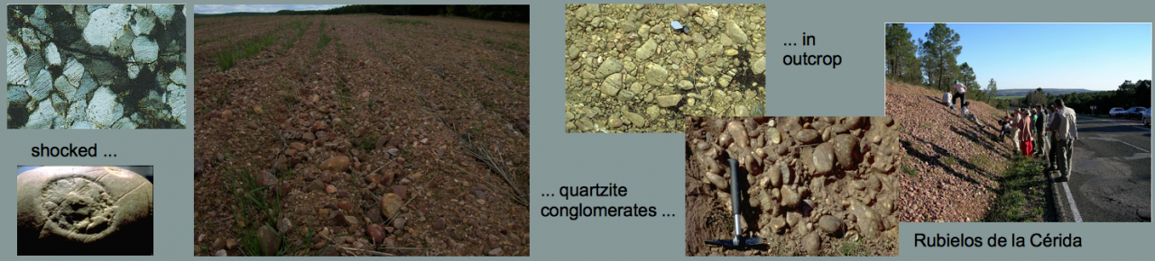
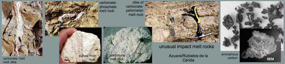
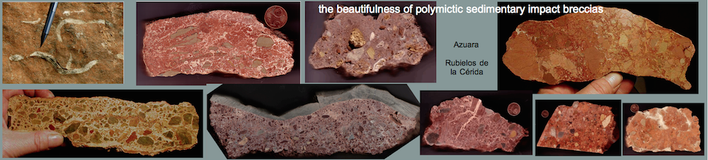
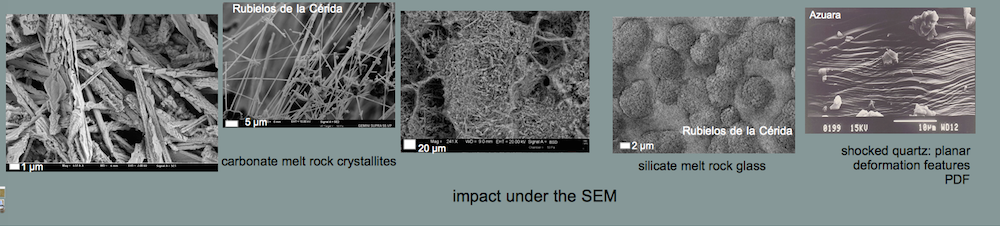
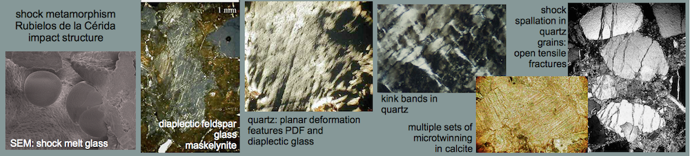
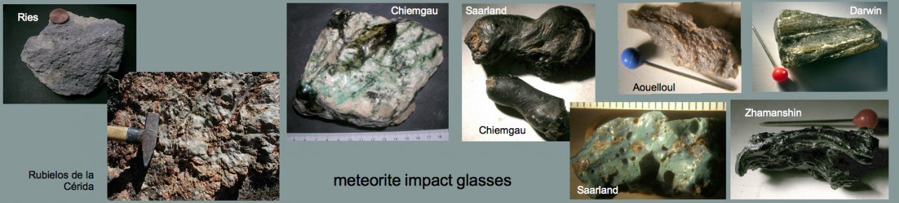
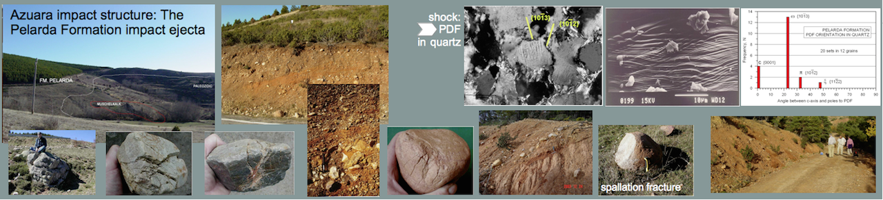
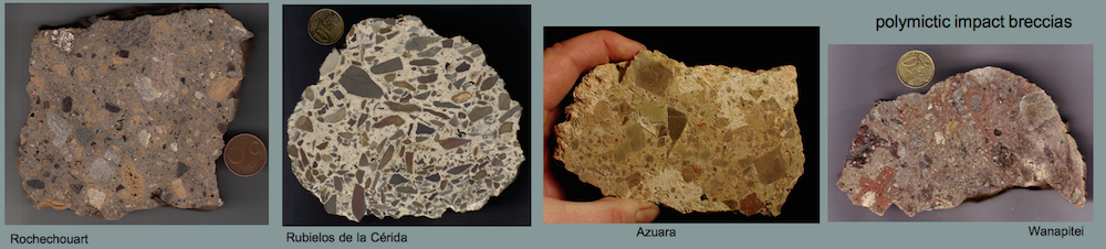
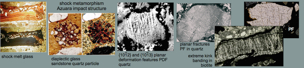
A second lacking, even more essential component is the fact that the regional geologists (chiefly from the Zaragoza university) without exception negate the existence of the Azuara impact event (Aurell et al. 1993, Aurell 1994, Cortés and Martínez 1999, Cortés and Casas 2002, Cortés et al. 2002, Diaz Martínez et al. 2002) despite all evidence as are the clear and proven shock metamorphism, ubiquitous polymictic and monomictic impact breccias, impact melt rocks, impact glasses, shatter cones, dislocated megablocks, geophysical anomalies, extended ejecta deposits, and much more, and a host of publications (referenced in the Introduction) and lengthy internet presentations [2, 3].
Half of the publications are taking the easy way out not mentioning the Azuara impact event at all, neither in the texts nor in the references (Casas et al. 2000, Capote et al. 2002, Cortés 1999, Cortés and Casas 2002, Gracia et al. 2008, Gutiérreza et al. 2008, 2011, 2012, Lafuente et al. 2010, 2011, Rubio and Simón 2007, Simón et al. 2010) which can simply be termed bad scientific style only.
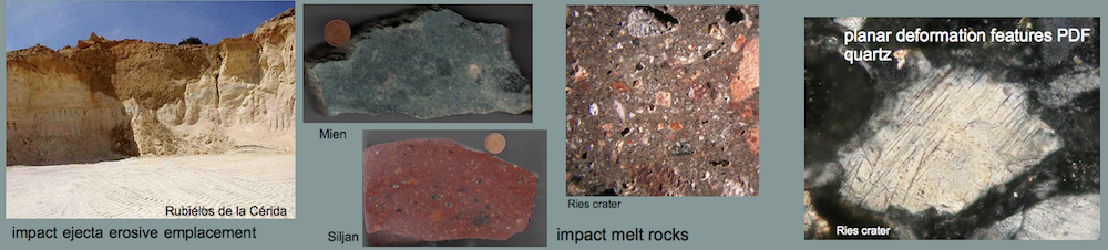
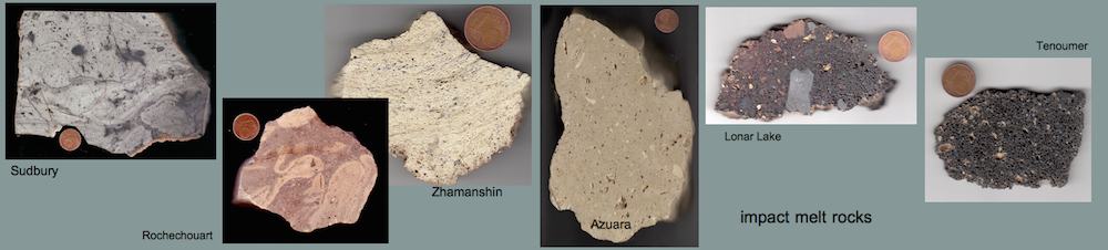
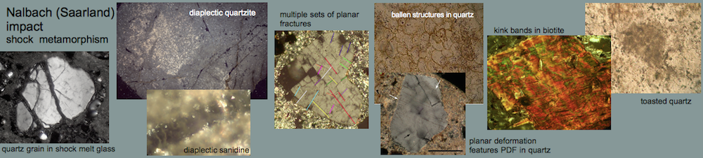
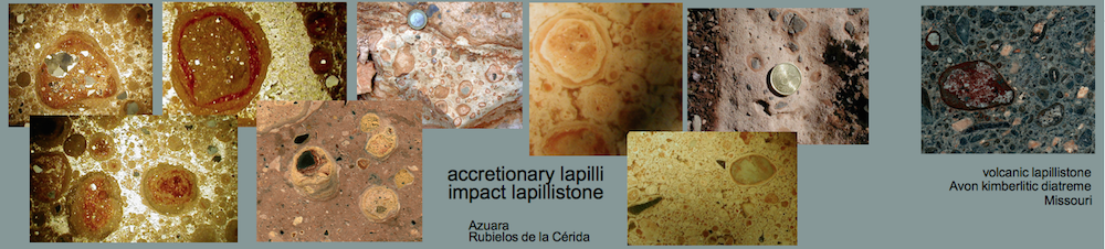
The other half of the publications take notice of the impact event but solely to claim its non-existence consistently ignoring the just mentioned host of clear impact evidence (Aurell et al. 1993, Aurell 1994, Cortés and Martínez 1999, Cortés and Casas 2002, Cortés et al. 2002, Diaz Martínez et al. 2002). The basis doesn’t differ from the attitude of the before-mentioned group of regional geologists: lacking thorough field work and lacking knowledge of elementary impact geology. Hence, their opposition is fed on theoretical models, on textbook knowledge, on simple assertions and sometimes even on falsification which we have lengthily addressed elsewhere [4]. For these geologists, the carefully analyzed impact melt rocks and impact glasses (Hradil et al. 2001) are volcanic ash, the polymictic, in part strongly shocked impact breccias and impact breccia dikes (Ernstson et al. 2002) are soil formation and karst features, the established shock effects like planar deformation features (PDFs) (Therriault 2000, Ernstson et al. 2002) and diaplectic quartz and feldspar glass (Ernstson et al. 2002) are tectonically produced, the Pelarda Fm. and Puerto Mínguez impressive impact ejecta deposits (Ernstson and Claudin 1990, Claudin et al. 2001, Ernstson et al. 2002) are Quaternary alluvial fans (see Figs. 20, 25) and Tertiary conglomerates, the young Tertiary fill in the middle of the Azuara impact structure is said to be undisturbed Devonian (J. Smit, written comm.), and so on.
We concede that in impact geology standard geological models frequently do not work adequately. Actually, big folds and faults, thick sediment deposits (ejecta) and deep-reaching erosion (cratering) are produced in an impact, but all this happens within a time of seconds and minutes accompanied by extreme pressures and in part extreme temperatures. Moreover, there are significant processes quite different from “normal” geology, and we especially mention the enormous, not to say gigantic tensile forces acting on the affected impact target from microscopic to megascopic scales. These tensile forces are the result of the reflection of the propagating compressive shock fronts at the free surface and at boundaries of different rock units. All this however is textbook knowledge for a long time.
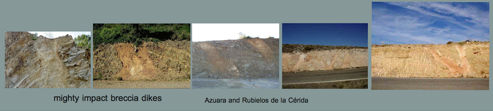
The regional geologists involved here could have learned much on impact geology if they had studied the very highlighting geologic exposures in the course of the road construction for the Autovía Mudéjar a few years ago and not far away from the Daroca – Cucalón – Olalla terrain [5]. In Fig. 41 we show typical examples of horizontally implanted breccia dikes in the Paleozoic rim region of the Azuara impact structure pointing to these enormous tensile forces vital for this exceptional constellation. Many more highlighting outcrops along the line of the Autovía Mudéjar in the impact rim region are also shown in [5]. Today these outcrops are no longer accessible because of the autovía in operation and especially because long sections of the embankments had to be secured by wire mesh and such are no longer visible. This had been necessary because during the road construction a large number of enormous landslides occurred in the already accomplished embankments (Fig. 42, [5]). The road constructors had not thought of going to build their roadway straight through the rim zone of a very large impact structure with its enormous rock destructions.

Fig. 41. Impact dikes exposed in the embankment of the Autovía Mudéjar in the rim zone of the Azuara impact structure. The implantation of the dikes has required enormous tensile forces.

Fig. 42. Only two of many landslides along a way of only a few kilometers that occurred after the embankments for the Autovía Mudéjar were already accomplished. More impressive landslides along the autovía embankments are shown in [5].
This demonstrates that ignoring a really existing impact structure by geologists has not only scientific negative relevance but also quite practical consequences. As for the scientific relevance we conclude that the abundant geological, tectonic and geomorphological models developed for the region between Zaragoza and Teruel are basically meaningless as long as the regional geologists are completely blocking out the Azuara impact event with the formation of the Azuara structure and the Rubielos de la Cérida elongated impact basin.
References
Aurell, M., González, A., Pérez, A., Guimerá, J., Casas, A., and Salas, R. (1993). Discussion of “The Azuara impact structure (Spain): New insights from geophysical and geological investigations” by K. Ernstson & J. Fiebag. Geologische Rundschau, 82: 750-755.
Aurell, M. (1994). Discusión sobre algunas evidencias presentadas a favor del impacto meteorítico de Azuara. In: Extinción y registro fósil (E. Molina, ed.), Cuadernos interdisciplinares, 5: 59-74, Seminario interdisciplinar de la Universidad de Zaragoza, Zaragoza.
Casas, A.M., Casas, A., Pérez, A., Tena, S., Barrier, L., Gapais, D., and Nalpas, T. (2000). Syn-tectonic sedimentation and thrust-and-fold kinematics at the intramountain Montalbán Basin (northern Iberian Chain, Spain). Geodinamica Acta. 1: 1-17.
Chao, E. C. T. (1974). Impact cratering models and their application to lunar studies – a geologist’s view. – Proc. Lunar Sci., 5, 35-52, Houston 1974
— (l976). Mineral-produced high pressure striae and clay-polish: key evidence for non-ballistic transport of ejecta from the Ries crater. – Science, 194, 615-618.
— (1977a). The Ries crater of southern Germany – a model for large basins on planetary surfaces. – Geol. Jb., A 43.
— (1977b). Preliminary interpretation of the 1973 Ries research deep drill core and a new Ries cratering model. – Geologica Bavarica, 75, 421-441.
— (1977c). Impact cratering phenomenon tor the Ries multiring structure based on constraints of geological, geophysical and petrological studies and the nature of the impacting body. With energy considerations by J. A. MJNKIN. — New York (Pergamon Press).
Chao, E.C.T, Schmidt-Kaler, H., and Hüttner, R. (1978). Principal exposures of the Ries meteorite crater in southern Germany. Description, photographic documentation and interpretation. München (Bayer. Geol. Landesamt), 84 p.
Capote, R., Munoz, J.A., Simón, J.L. (coord.), Liesa, C.L., and Arlegui, L.E. (2002): Alpine tectonics I: the Alpine system north of the Betic Cordillera. In: Gibbons, W. and Moreno, T., eds. 367-400. The Geology of Spain. London (Geological Society).
Claudin, K., Ernstson, K., Rampino, M.R., and Anguita, F. (2001). Striae, polish, imprints, rotated fractures, and related features in the Puerto Mínguez impact ejecta (NE Spain). Abstracts, 6th ESF IMPACT workshop, Impact Markers in the Stratigraphic record, pp. 15-16.
Claudin, F. and Ernstson, K. (2003). Geologia planetaria y Geologia regional: el debate sobre un impacto múltiple en aragón. Enseñanza de las ciencias de la Tierra, vol 11, nº 3, pp 202-212.
Colomer i Busquets, M. and Santanach i Prat, P. (1988). Estructura y evolución del borde sur-occidental de la Fosa de Calatayud-Daroca. Geogaceta, 4, 29-31.
Cortés, A.L. (1999). Evolución tectónica reciente de la Cordillera Ibérica, Cuenca del Ebro y Pirineo centro-occidental. PhD Thesis, University of Zaragoza: 406 p.
Cortés, A.L. and Martínez, M.B. (1999). Controversia científica para el aula: ¿ tiene la cubeta de Azuara un origen extraterrestre? Enseñanza de las Ciencias de la Tierra, 7.2: 143-157.
Cortés, A.L. and Casas, A.M. (2000): ¿Tienen el sistema de fosas de Teruel origen extensional? Revista de la Sociedad Geológica de España, 13, 445-470.
Cortés, A.L., Díaz-Martínez, E., Sanz-Rubio, E., Martínez-Frías, J., and Fernández, C. (2002). Cosmic impact versus terrestrial origin of the Azuara structure (Spain): A review. Meteoritics Planet. Sci., 37: 875-894.
Diaz Martínez, E., Sanz Rubio, E. y Martinez Frias, J. (2002): Sedimentary record of impact events in Spain. Geological Society of America. Special Paper 356: 551-562.
Ernstson, K.(1991). Azuara: un impacto meteoritico! – Astrum, 97, 13.
Ernstson, K. (1994). Looking for Geological Catastrophes: The Azuara Impact Case. – In: Extinción y registro fósil (Extinction and the fossil record, E. Molina, ed.), Cuadernos Interdisciplinares No. 5, 31-57, SIUZ.
Ernstson, K., Hamman, W., Fiebag, J., and Graup, G. (1985). Evidence of an impact origin for the Azuara structure (Spain). – Earth Planet. Sci. Let., 74, 361-370.
Ernstson, K., Feld, H., and Fiebag, J. (1987). Impact hypothesis for the Azuara structure (Spain) strengthened. Meteoritics, 22, 373.
Ernstson, K. & Claudin, F.(1990). Pelarda Formation (Eastern Iberian Cains, NE Spain): Ejecta of the Azuara impact structure. – N.Jb.Geol.Paläont.Mh., 1990, 581-599.
Ernstson, K. & Fiebag, J.(1992). The Azuara impact structure (Spain): new insights from geophysical and geological investigations. – Int. J. Earth Sci., 81/2, 403-427.
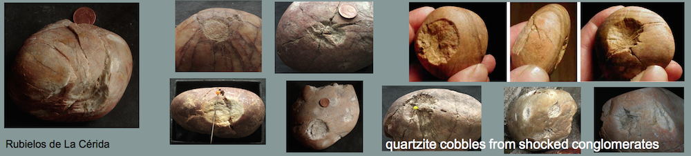
Ernstson, K., Rampino, M.R., and Hiltl, M. (2001). Cratered cobbles in Triassic Buntsandstein conglomerates in NE Spain: Shock deformation of in-situ deposits in the vicinity of large impacts. Geology, v. 29, no.1, 11-14.
Ernstson, K., Rampino, M.R., and Hiltl, M. (2001). Shock-induced spallation in Triassic Buntsandstein conglomerates (Spain): an impact marker in the vicinity of large impacts. Abstracts, 6th ESF IMPACT workshop, Impact Markers in the Stratigraphic record, pp. 25-26.
Ernstson, K., Claudin, F., Schüssler, U., Anguita, F, and Ernstson, T. (2001) Impact melt rocks, shock metamorphism, and structural features in the Rubielos de la Cérida structure, Spain: evidence of a companion to the Azuara impact structure. Abstracts, 6th ESF IMPACT workshop, Impact Markers in the Stratigraphic record, pp. 23-24.
Ernstson, K., Claudin, F., Schüssler, U., Hradil, K. (2002). The mid-Tertiary Azuara and Rubielos de la Cérida paired imapct structures (Spain). Treb. Mus. Geol. Barcelona, 11, 5-65.
Ernstson, K., Schüssler, U., Claudin, F., Ernstson, T. (2003). An Impact Crater Chain in Northern Spain. – Meteorite, 9, 35-39.
Gracia, F.J., Gutiérrez, F., Gutiérrez, M. (2008): Discussion of “Tectonic subsidence v. erosional lowering in a controversial intramontane depression: the Jiloca basin (Iberian Chain, Spain)”. Geological Magazine 145, 591-594.
Gutiérreza, F., Gutiérreza, M., Gracia, F.J., McCalpinc, J.P., Luchaa, P., and Guerrero, J. (2008). Plio-Quaternary extensional seismotectonics and drainage network development in the central sector of the Iberian Chain (NE Spain). Geomorphology, 102, 21-42.
Gutiérrez, F., Lucha, P., Guerrero, J., Gutiérrez, M., and Carbonel, D. (2011): Discussion on the article “Paleoseismological analysis of an intraplate extensional structure: the Concud fault (Iberian Chain, Eastern Spain)” by P. Lafuente, L.E. Arlegui, C.L. Liesa, J.L. Simón. International Journal of Earth Sciences. doi: 10.1007/s00531-011-0660-4.
Gutiérrez, F., Gracia, F.J., Gutiérrez, M., Lucha, P., Guerrero, J., Carbonel, D., and Galve, J.P. (2012): A review on Quaternary tectonic and nontectonic faults in the central sector of the Iberian Chain, NE Spain. Fallas cuaternarias tectónicas y gravitacionales en el sector central de la Cordillera Ibérica, NE de España. Journal of Iberian Geology 38 (1), 145-160.
Hernández, A., Olivé, A., Sdzuy, K., Kolb, S., Moissenet, E., Carls, P. (1983): Hoja geológica num. 465 (Daroca). Memoria y Mapa Geológico de España, E: 1:50.000. I.G.M.E., Madrid.
Hradil, K., Schüssler, U., and Ernstson, K. (2001). Silicate, phosphate and carbonate melts as indicators for an impact-related high-temperature influence on sedimentary rocks of the Rubielos de la Cérida structure, Spain. Abstracts, 6th ESF IMPACT workshop, Impact Markers in the Stratigraphic record, pp. 49-50.
IGME (Instituto Geológico y Minero de España) (1985). Mapa Geológico de España, Escala 1 : 200.000. Teruel, Mapa y Memoria (192 p.). Madrid.
ITGE (Instituto Tecnológico GeoMinero de España) (1991). Mapa Geológico de España, Escala 1 : 200.000. Daroca, Mapa y Memoria (239 p.). Madrid.
Lafuente, P., Arlegui, L.E., Liesa, C.L., Simón, J.L. (2010). Paleo-Paleoseismological analysis of an intraplate extensional structure: the Concud fault (Iberian Chain, Eastern Spain). International Journal of Earth Sciences. doi: 10.1007/s00531-010-0542-1.
Lafuente, P., Arlegui, L.E., Liesa, C.L., Simón, J.L. (2011). Reply to the discussion by F. Gutiérrez, P. Lucha, J. Guerrero, M. Gutiérrez and D. Carbonel on the article “Paleoseismological analysis of an intraplate extensional structure: the Concud fault (Iberian Chain, Eastern Spain)”. International Journal of Earth Sciences 101(2), 1-7.
Monninger W. (1973). Erläuterungen zur geologischen Kartierung im Gebiet um Olalla (Prov. Teruel), NE-Spanien. Diplomarbeit Universität Würzburg, 140 p.
Pohl, J., Stöffler, D., Gall, H. & Ernstson, K. (1977). The Ries impact crater.- In: Impact and Explosion Cratering (D.J.Roddy, R.O.Pepin, and R.B.Merrill, eds.), 343-404, Pergamon Press, New York.
Reiff, W. (1978). Monomict movement breccias; an indicator of meteorite impact. Meteoritics, 13: 605-609.
Rubio, J.C. and Simón, J.L. (2007). Tectonic subsidence v. erosional lowering in a controversial intramontane depression: the Jiloca basin (Iberian Chain, Spain). Geological Magazine 144, 127-141.
Simón, J.L., Rubio, J.C., Soriano, M.A. (2010). Sobre el origen de la depresión del Jiloca (Teruel, Cordillera Ibérica centro-oriental). Geogaceta 48, 183-186.
Simón, J.L., Lafuente, P., Arlegui, L.E., Liesa, C.L., and Soriano, M.A. (2005). Caracterización paleosísmica preliminar de la falla de Concud (fosa del Jiloca, Teruel). [Preliminary paleoseismic characterization of the Concud fault (Jiloca graben, Teruel, Spain)] Geogaceta 38, 63-66.
Stöffler, D. (1977). Research drilling Nördlingen 1973: polymict breccias, crater basement, and cratering model of the Ries impact structure. – Geologica Bavarica, 75, 443-458.
Stöffler, D., Gault, D.E., Wedekind, J., and Polkowski, G. (1975). Experimental hypervelocity impact into quartz and sand: distribution an shock metamorphism of ejcta. -J. Geophys. Res., 80, 4062-4077.
Therriault, A. (2000): Report on Azuara, Spain, PDFs, 31 p.
URLs:
[2] https://www.impact-structures.com/impact-spain/the-azuara-impact-structure/
[3] https://www.impact-structures.com/impact-spain/the-rubielos-de-la-cerida-impact-basin/