

by Ferran Claudin & Kord Ernstson (2012)
Abstract
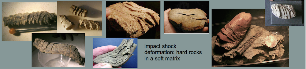
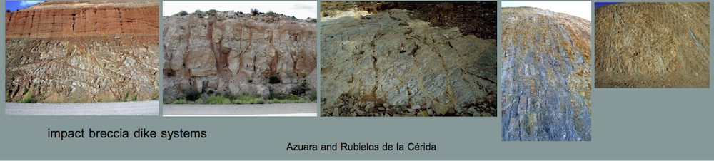
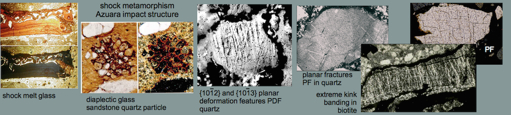
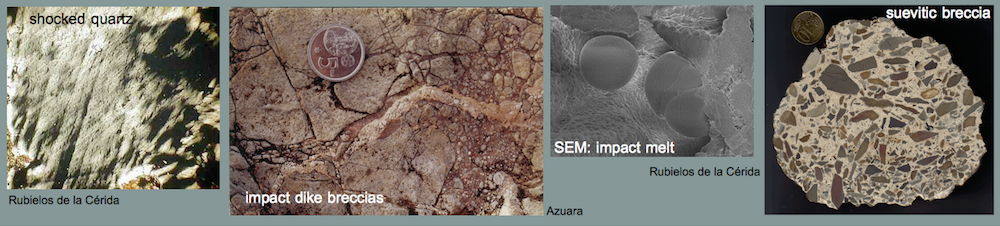
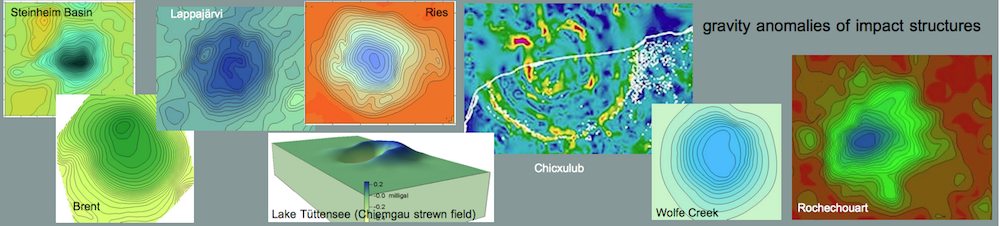
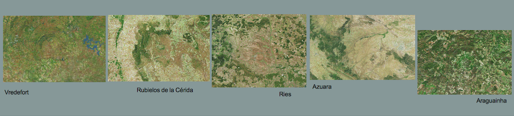
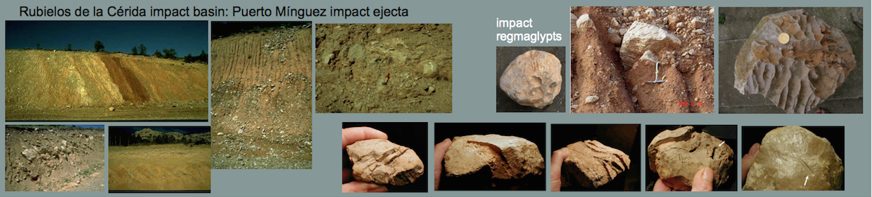
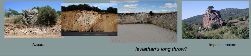
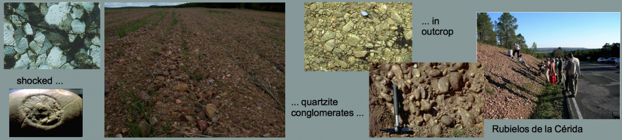
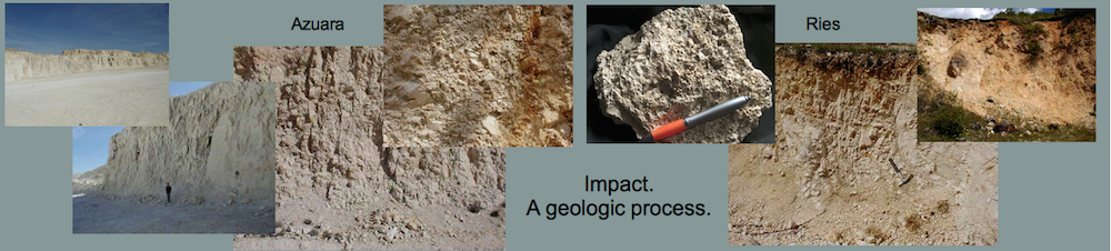
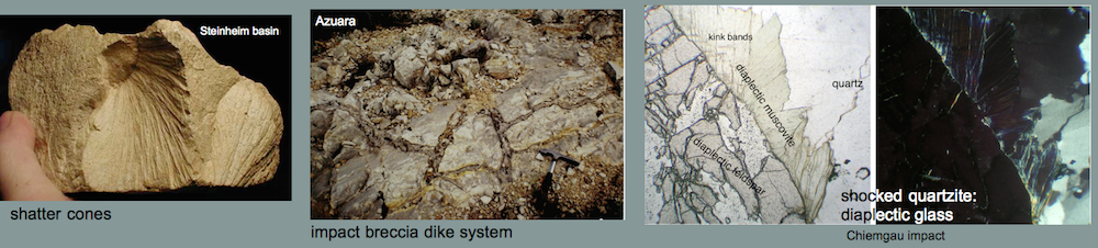
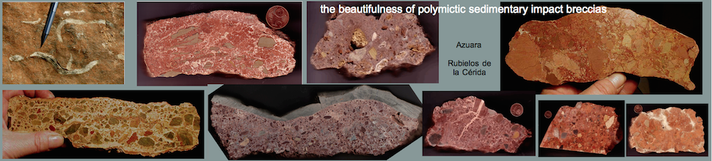
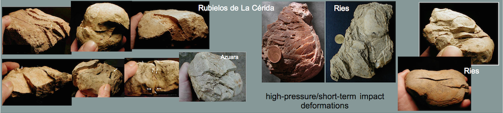
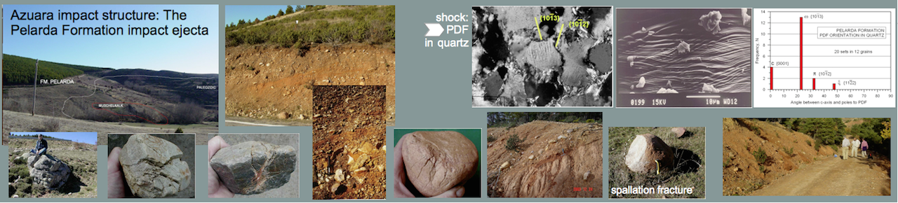
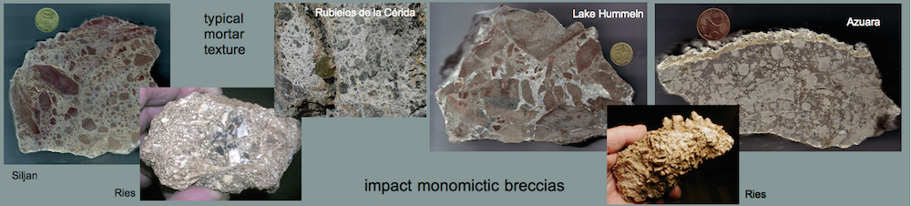
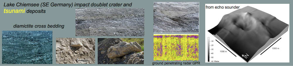
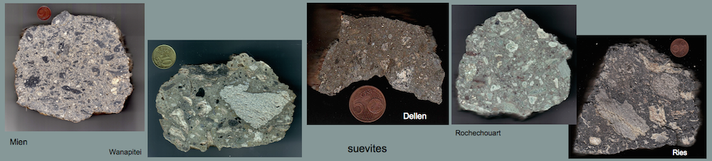
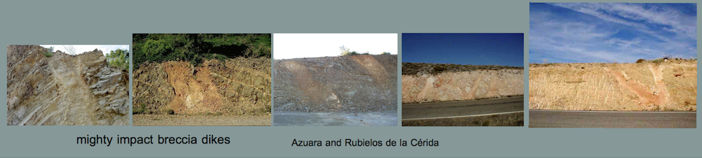
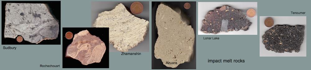
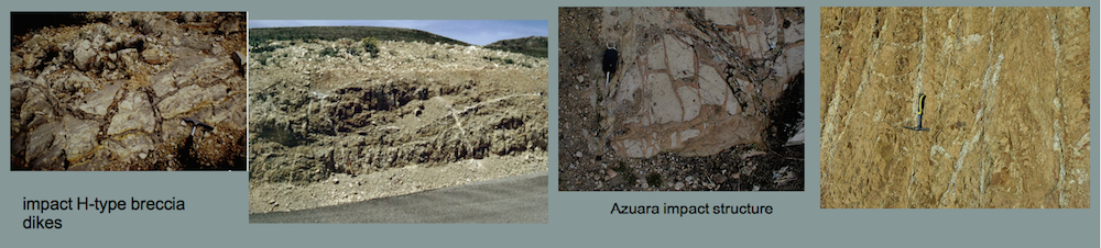
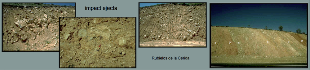
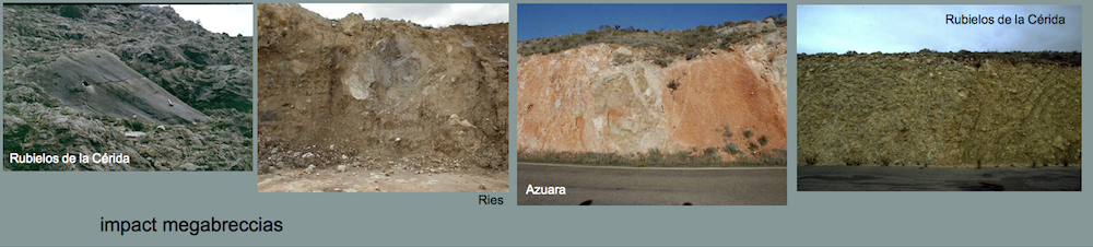
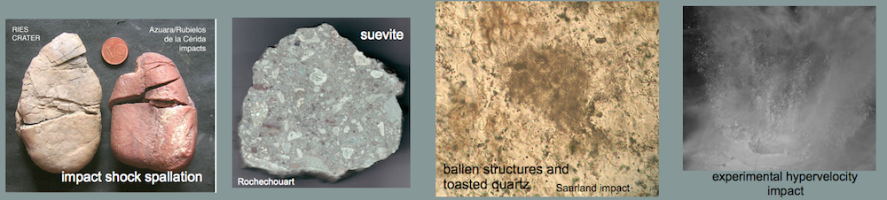
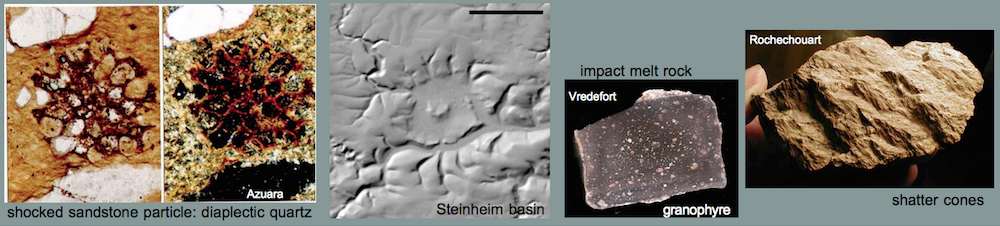
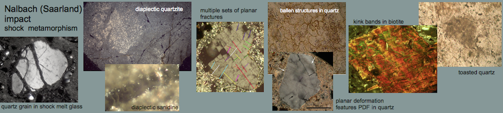
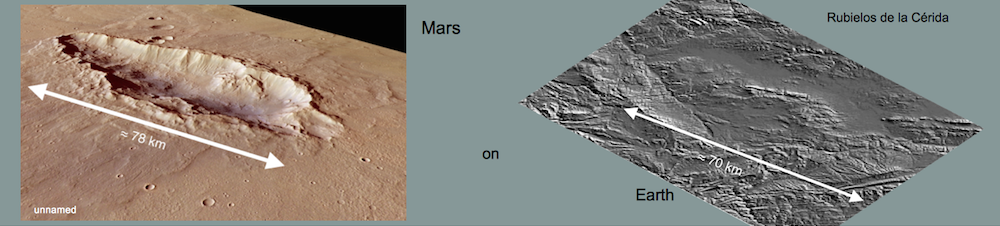
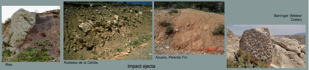
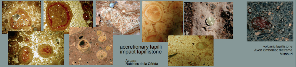
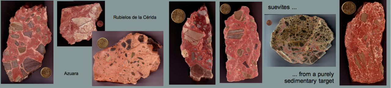
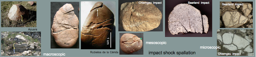
A nappe-like thrust of Cambrian over Tertiary, the Daroca thrust, in northeast Spain has puzzled geologists since longtime. Because of a lacking root zone and a lacking relief it didn’t match a reasonable geologic pattern. In the younger regional geologic literature the thrust is nevertheless incorporated in Alpine regional tectonics. An obviously first closer investigation of the involved Cambrian and Tertiary units, their facies and structural setting leads to a model that relates the Daroca thrust to the nearby roughly 40 km-diameter Azuara impact structure. The thrust is part of the excavation stage of impact cratering which may have affected both the Cambrian plate and the diamictic Tertiary below. The model is strongly substantiated by comparison with the Ries impact structure where similar thrusts and related features occur. The Daroca thrust is one more example reflecting the work of the regional geologists who pretend the giant Azuara impact event with the formation of the Azuara impact structure and the adjacent about 70 km Rubielos de la Cérida elongated impact basin never happened. Hence, all their regional geologic models still developed which completely ignore the impact and its radical influence on the Tertiary regional geology are without any scientific relevance.
1 Introduction

Fig. 1. Daroca, Province of Zaragoza, Spain.
The very nice town of Daroca in the Spanish Province of Zaragoza (Fig. 1) hides a peculiar geologic scenario – an enigma for geologists from time out of mind. Being enthroned above the town the geologic stratigraphy shows with a very sharp cut Cambrian dolomite (Ribota dolomite) over Tertiary young sediments (Fig. 2). Older layers over younger ones are not uncommon in geology, and overthrust and thrust faulting are related processes. Continue reading “Azuara impact structure: The Daroca thrust geologic enigma – solved? A Ries impact structure analog”


